Below are some quick tips on how to navigate this website:
Click on Scott Hampton Photography (upper left) to get back to the Home
Page.
While on the Home Page you can cycle throught the thunbnails and select
the collection you want to view. You must then click/tab on the larger image above to
enter that particular collection.
Slideshow automatically rotates image approximately every five seconds. Alternatively, you can swipe, drag (mouse), and even use the arrows on your keyboard to cycle through the photographs and/or thumbnails.
You can click/tap on the photo to get a description.
Index
Dead Horse Point

Looking Over the Virgin River near Grafton, Utah

Ekker Butte

Ekker Butte II

Ham Rock, Arches NP

Temple of the Sun

Torrey Cabin

Boulder Ranch

Antelope Canyon

Cart, Capital Reef

Fruita School House,
Capital Reef

Farm Equipment,
Capital Reef

Farm Equipment in Toroweap

Monument Valley Overlook

Factory Butte

Alstrom Point, Gunsite Butte
.webp)
The Straight and Narrow Road

Butte by Ducket Crossing

Formations in Glenn Canyon

Stormy Skys

The Hillers

The Kanab Heritage House
and Museum
Dead Horse Point II
Cloud in the Hole, Arches NP

Dead Horse Point III
Burr Trail, Cactus Bloom

Moon Butte II

Aspen Rising
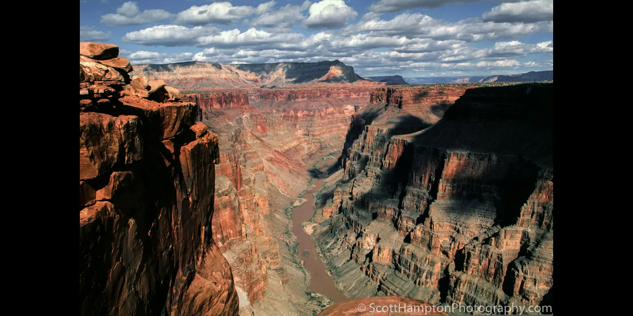
Toroweap Overlook, South Rim, Grand Canyon

Scenic Hwy 12 just East of Cannonville, Utah

Hole-In-The-Rock Corral

Hole-In-The-Rock Corral II

Desert Horses

Devil's Garden

West & East Mitten Buttes,
Monument Valley

Bentonite Hills II

Farm House, Capital Reef

Hovenweep

Hovenweep II

Arizona Strip

Castle Butte,
Valley of the Gods

Kanab Point

Monument Valley

''Picture Window''

It was tough waking up to this view!

Moon Butte

Lake Powell Sunrise Looking West

Friends of the Animals Barn

Navajo Power Plant

Moonrise (Sunset at Goblin Valley)

Friends of the Animals

Goblin Valley at Sunset

The Butte with no Name

A Ford Dealership II

The Hobbit Holes of Glen Canyon

Bryce on Fire

Fall Colors at Roof Butte

Cottonwood Canyon Road

Cottonwood Canyon Road II

I Found the Ford Dealership

Long Canyon Ford

Airport Tower

Bryce Point Overlook

Rain Angels in the Buckhorn Wash I

Rain Angels in the Buckhorn Wash II

Rain Angels in the Buckhorn Wash III

Rain Angels in the Buckhorn Wash IV

Rain Angels in the Buckhorn Wash V

Rain Angels in the Buckhorn Wash VI

Rain Angels in the Buckhorn Wash VII

My Jeep at the ''Top of the World''

Motorcycles at the ''Top of the World''

Close to the Edge at the ''Top of the World''

Sunset Tree

Island in the Sky
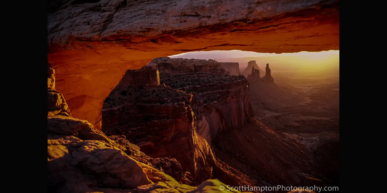
Mesa Arch Sunrise

Canyonlands Corral
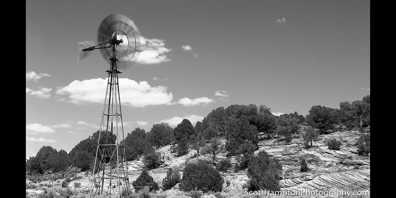
Rosy Canyon Mill

Devil's Garden, Cheshire Lookout

Pahreah, Utah

Antelope Canyon II
Sand Stream

Sunrise, Bryce Point
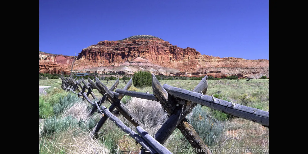
Torrey Ranch
Burr Trail, Wave

Dead Horse Point

Canyon Cactus
Grosvenors Arch

Cottonwood Canyon Road III

Kodachrome Basin I

Kodachrome Basin II

Kodachrome Basin III
Arch at Devil's Garden
T-Rex in the Shadows

On the Road to Canyonlands

Colorado River flowing through
the Canyonlands

Colorado River with the
LaSalle Mountain Range
in the Background

The "Windows" of Arches

Balanced Rock I

Balanced Rock II
Fremont River Home

Thank You!

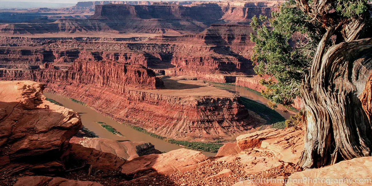
Dead Horse Point
I love visiting this place not only for this view but also the wonderful views in nearby Canyonlands National Park. The sky was extremely overcast so I cropped the top of this photo. I remember I was too lazy to install my ND grad filter or perhaps this capture would have included a nice sky.
Ham Rock
On my way to capture a sunset at "Windows" (Arches NP) when I saw this. I decided to forgo Windows in place of this one!
Coral Pink
I would have some nice close-ups but the OHV tracks ruin it. Not worth coming to if you plan on photographing the dunes.
Temple of the Sun
Temple of the Sun is a 400-foot monolith located in Capitol Reef National Park located in Utah, USA. This remote, iconic monolith is situated in the Middle Desert of the park's North (Cathedral Valley) District. Cathedral Valley was so named in 1945 by Charles Kelly, first superintendent of Capitol Reef National Monument, because the valley's sandstone monoliths reminded early explorers of ornate, Gothic cathedrals, with fluted walls, alcoves, and pinnacles.
Temple of the Sun is composed of unfractured, buff-pink Entrada Sandstone. The sandstone, which was originally deposited as sandy mud on a tidal flat, is believed to have formed about 160 million years ago during the Jurassic period as a giant sand sea, the largest in Earth's history.
Looking Over the Virgin River near Grafton, Utah
Looking over the Virgin River near Rockville, Utah. Towards the left is Eagles Crags West. On the right is Smithsonian Butte with Canaan Mountain sweeping across the picture. It is the last hour of sunlight this evening with the light dancing on the autumn colors.
Ekker Butte
Ekker Butte is a 6,260-foot elevation summit which towers over 1,400 feet above the surrounding terrain. It is located in the northern reach of Glen Canyon National Recreation Area, Utah. This geological landmark is named for the pioneering Art Ekker family which operated the nearby Robbers Roost Ranch and grazed cattle on land adjacent to the nearby Maze. Robbers Roost famous for the hideout of outlaw Butch Cassidy and the Wild Bunch.
Ekker Butte is composed of hard, fine-grained Wingate Sandstone, which is the remains of wind-borne sand dunes deposited approximately 200 million years ago in the Late Triassic. This Wingate sandstone, capped by Kayenta Formation, forms steep cliffs as it overlays softer layers of the Chinle Formation, which is exposed down to a prominent ledge formed by the Moss Back Member. Slopes below this ledge are Moenkopi Formation, down to the White Rim. Precipitation runoff drains into the nearby Green River, which in turn is part of the Colorado River drainage basin.
Ekker Butte II
Ekker Butte is a 6,260-foot elevation summit which towers over 1,400 feet above the surrounding terrain. It is located in the northern reach of Glen Canyon National Recreation Area, Utah. This geological landmark is named for the pioneering Art Ekker family which operated the nearby Robbers Roost Ranch and grazed cattle on land adjacent to the nearby Maze. Robbers Roost famous for the hideout of outlaw Butch Cassidy and the Wild Bunch.
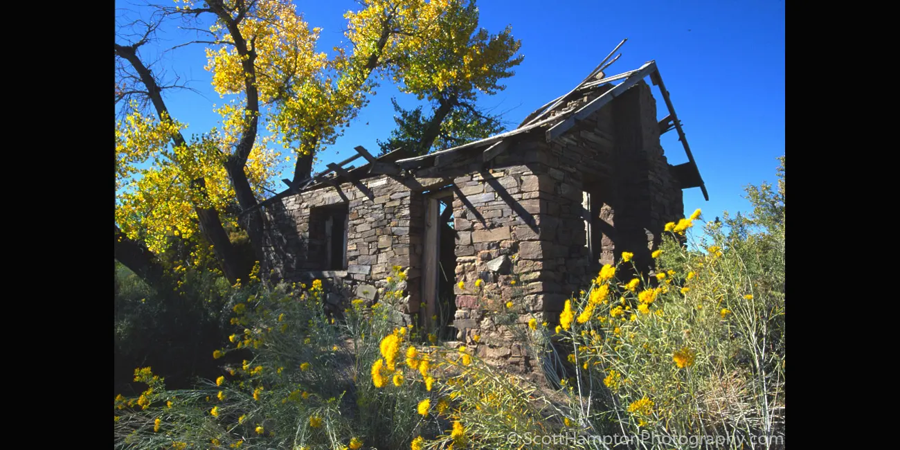
Torrey Cabin
I found this cabin (more like a home) outside the town of Torrey, Utah. The town was established in the 1880s by Mormon settlers, and was initially known as Youngtown, after John Willard Young. The town is generally held to be named after Jay L. Torrey from Pittsfield, Illinois. Torrey was a member of the Wyoming legislature, who, upon the advent of the Spanish–American War, achieved national attention by proposing the creation of what became three volunteer cavalry regiments, made up of cowboys and stockmen.
Boulder Ranch
This ranch boarders a town called Boulder, Utah. Boulder is the starting/ending point for the famous Burr Trail which I have visited a few times over the years. A few 100 feet from the entrance to the Burr Trail is a restaurant called the Burr Trail Grill which serves one of the best hamburgers I have ever had! I make it a point to stop here if I am in the area. By the way, if you have a 4x4 and enjoy exploring, the Burr Trail is a must… especially if you are a photographer. The Burr Trail is 68 miles of scenic wonders which often takes me two or three days to complete. Dispersed camping is allowed but there are not a lot of facilities.
Antelope Canyon
A major attraction made popular because of photography. Ironically, it is almost impossible to capture a good long exposure because there are too many people walking through. If I understand correctly there are no more photography tours because the park officials feel it is slowing down all the tours they feed through this place. Talking about biting the hand that feeds you!
Cart, Capital Reef
Been to this spot a couple times before but either the weather or the shadows were not cooperating. Finally, this time I have the place nicely lit with a few clouds and a nice blue sky.
Capitol Reef National Park is a 100-mile pinch in the earth’s crust in the geographical middle of nowhere, but it is overloaded with geological, cultural, and sensory consequence.
School House, Capital Reef
I have shot this cart since 1994 (about 4-5 visits.) This is my best one yet ((c) 2007.) Only way I can top this is with a late October shot (trees turn golden.)
Capitol Reef National Park is a 100-mile pinch in the earth’s crust in the geographical middle of nowhere, but it is overloaded with geological, cultural, and sensory consequence.
Fruita Schoolhouse
I have shot this cart since 1994 (about 4-5 visits.) This is my best one yet ((c) 2007.) Only way I can top this is with a late October shot (trees turn golden.)
Classes had been conducted for two years before the Fruita Schoolhouse was built, when Elijah Cutler Behunin donated land for a school building in 1896. He and other early Junction (later called "Fruita") settlers constructed the building. Even though only eight families lived in Junction, these farmers had large families. The Behunins raised thirteen children themselves, one of whom, Nettie, became the first schoolteacher, at age twelve. She taught children in the Behunin home before the schoolhouse was built. Nettie's first class had 22 students, three of whom were her siblings.
Farm Equipment, Capital Reef
Farm equipment probably first used and owned by the Gifford family who farmed this area called Fruita.
Fruita is the center of activities and services at Capitol Reef National Park. The village is located on Utah State Route 24, about 10 miles east of Torrey and 36 miles west of Hanksville. Nestled in a beautiful canyon at the junction of the Fremont River and Sulphur Creek, Fruita was founded in the 1880s when Mormon pioneers settled there.
Farm Equipment in Toroweap
Just some farm equipment I stumbled upon very close right next to the Toroweap Ranger station. Looks like it is some type of tiller.
Monument Valley Overlook
I was walking down this short trail just hoping I could find a good foreground to support this beautiful background. I could not believe I ran into this ''disc'' looking rock sticking up from the ground.
Factory Butte
I was thinking of walking across the dried riverbed to get tighter shots on the purple plants, however, I realized that Factory Butte would have been hidden by the plateau in front of it. As I am writing this I realize just how many ''life cycles'' this river went through. It is amazing! This type of hydrolyzation is common throughout Southern Utah and Northern Arizona.
Alstrom Point, Gunsite Butte
Lake Powell Sunset Looking East. It takes about four hours to get here from the main road. That is if you drive directly and you drive fast (10mph.) I knew it would not be practical to photograph this area without camping here a couple of days. I really enjoyed the peace and serenity... only saw three 4x4s the whole time.
The Straight and Narrow Road
Been on this road a few times in my life. It is most famous for the ‘’straight line’’ the road created in this image. I got lucky on one of my visits to arrive here just after the road was repaved. Clearly the road is the main feature here but do not forget how beautiful the background is.
Butte by Ducket Crossing
Butte by Ducket Crossing, I was exploring the 4x4 trails in the Hite area of Glenn Canyon while trying to find a spot that might let the sun peek through. You see it was a very stormy day and by this time the sky was overcast and gray. Being a landscape photographer, I am not a real fan of gray skies and the sun was going to set soon. I looked to the south and notice the sunlight off into the distance. I hopped into my Jeep and drove south on Utah Hwy 95. After about ten miles I began to see the light as I entered this amazing area with large puffy clouds and colorful light dancing along the desert floor. Much to my delight I realized I had met the storms’ edge. So, I decided to get off the main road (Hwy 95) and explore the backcountry. Much to my delight I found this place soon before the sun was to set. Although I was disappointed these amazing clouds were not near my focus for this evening (the Hite Crossing Bridge.) I was still rewarded with the wonderful show that nature decided to provide for me here.
Stormy Skys
I was exploring the 4x4 trails in the Hite area of Glenn Canyon while trying to find a spot that might let the sun peek through. You see it was a very stormy day and by this time the sky was overcast and gray. Being a landscape photographer, I am not a real fan of gray skies and the sun was going to set soon. I looked to the south and notice the sunlight off into the distance. I hopped into my Jeep and drove south on Utah Hwy 95. After about ten miles I began to see the light as I entered this amazing area with large puffy clouds and colorful light dancing along the desert floor. Much to my delight I realized I had met the storms' edge. So, I decided to get off the main road (Hwy 95) and explore the backcountry. Much to my delight I found this place soon before the sun was to set. Although I was disappointed these amazing clouds were not my focus for this evening (the Hite Crossing Bridge.) I was still rewarded with the wonderful show that nature decided to provide for me here!
The Hillers
Inside Capitol Reef National Park pointed towards Mount Hillers range.
The Kanab Heritage House
The Heritage House is a timeless work of art that showcases the rich history of Kanab and its people. The Kanab Heritage House has stood resolute in Kanab for over a century and has many tales to tell.
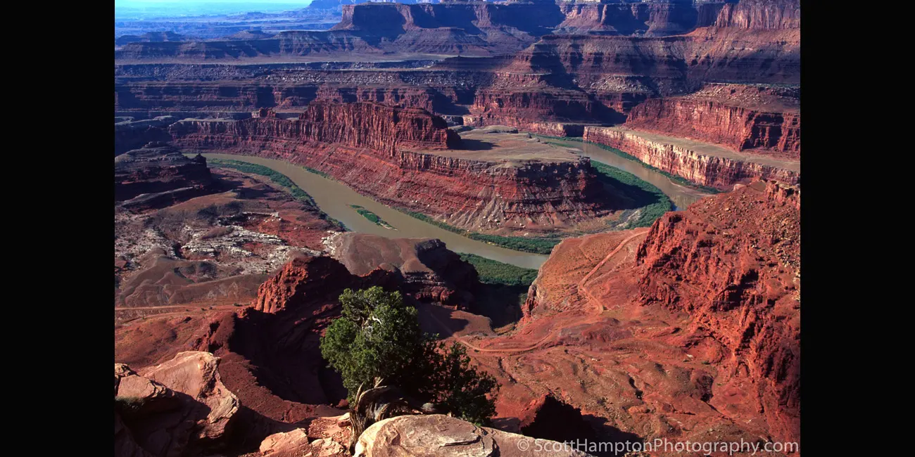
Dead Horse Point II
According to legend, the park is so named because of its use as a natural corral by cowboys in the 19th century, where horses often died of exposure. Dead Horse Point has frequently been noted on lists of unusual place names. Dead Horse Point State Park appeared in the final scene in the 1991 film Thelma & Louise.
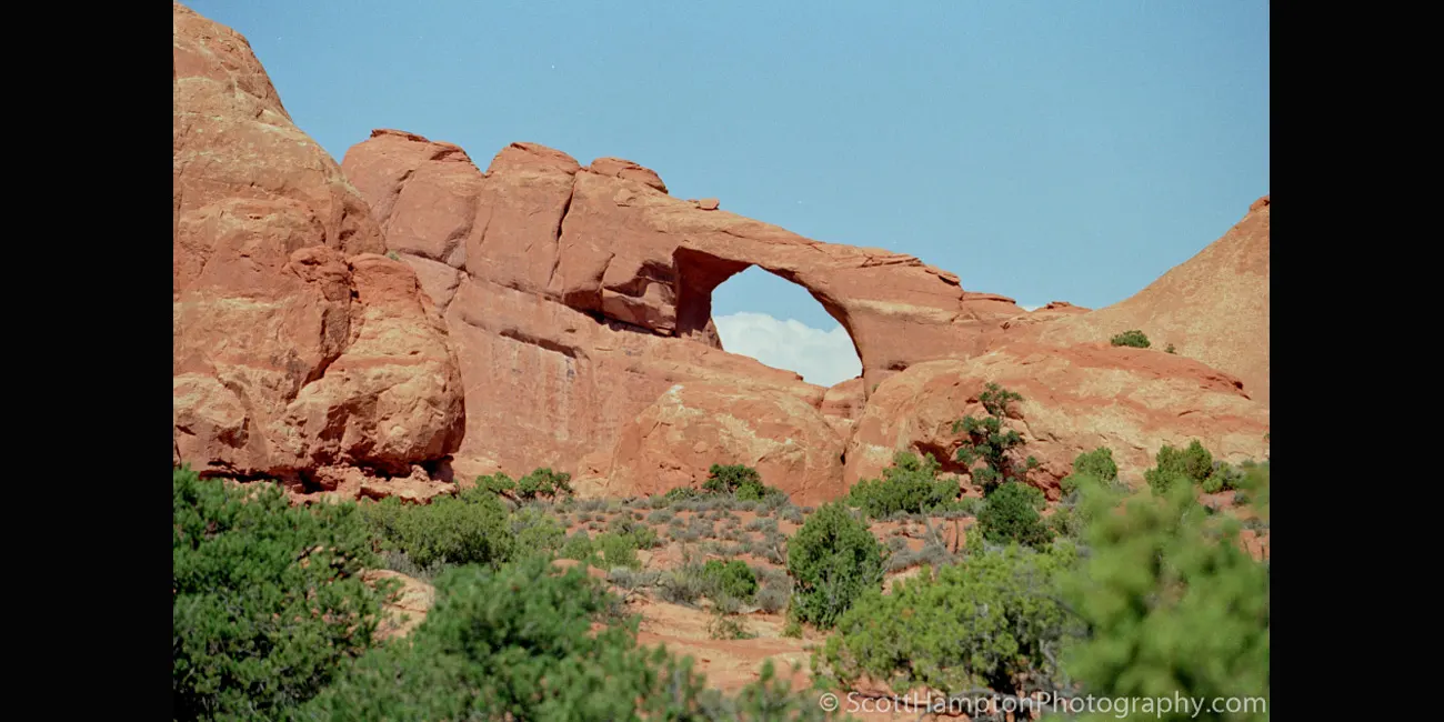
Cloud in the Hole, Arches NP
This is just one of over 2,000 arches located in Arches National Park. The park consists of 76,679 acres of high desert located on the Colorado Plateau. The highest elevation in the park is 5,653 feet at Elephant Butte, and the lowest elevation is 4,085 feet at the visitor center. The park receives an average of less than 10 inches of rain annually.
Administered by the National Park Service, the area was originally named a national monument on April 12, 1929 and was redesignated as a national park on November 12, 1971. The park received more than 1.6 million visitors in 2018.
Dead Horse Point III
Dead Horse Point State Park features an 8-mile hiking trail that includes loops and overlooks on the East Rim Trail and the West Rim Trail. The Intrepid Trail System contains 17 miles of single-track mountain bike trails with loops of varying levels of difficulty.
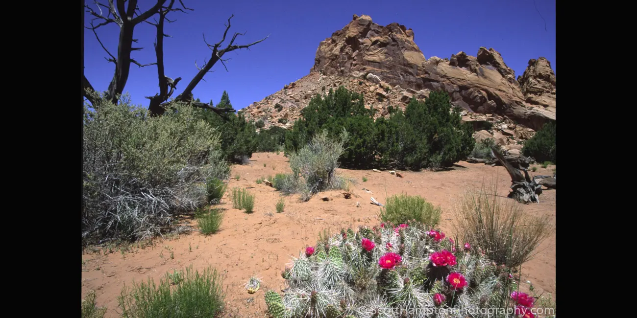
Burr Trail, Cactus Bloom
The Burr Trail was originally developed as a cattle trail blazed by stockman John Atlantic Burr, the Burr Trail Scenic Backway is now one of the most picturesque drives in Utah. A paved and graded, gravel and dirt road, it extends from Boulder to Bullfrog Marina, passing through the Grand Staircase-Escalante National Monument, Capitol Reef National Park, and Glen Canyon National Recreation Area.
Moon Butte II
Moon Butte, Found this spot near Alstrom Point. Obviously, the white line (calcium) attracted me to this shot. This was almost like a ''eureka moment'' when it came to lines pointing towards the foreground. I am sure any professional photographer would think of this as being remedial. Wish I was willing to read more books on the subject perhaps I would have figured this one out a little sooner. I did take a class in college called Visual Perception which was a prerequisite for beginning B&W photography. My original intent was to continue with some more photography classes, but I was worried about ‘’side-tracking’’ my major.
Aspen Rising
I liked the way these Aspen trees seem to converge. I also like the way it ‘’pulls’’ you up. This photo was taken a little west of a small community called Duck Creek Village in southern Utah.
Toroweap Overlook, South Rim, Grand Canyon
At 3,000 vertical feet above the Colorado River, it is easy to get a little dizzy so close to the edge.
Situated below the iconic rim of Grand Canyon, a visit to Tuweep provides an opportunity for an uncrowded, rustic, and remote experience. Access is challenging and demands skill at negotiating difficult roadways. Although I did not camp here, there is dispersed camping allowed in this area.
Scenic Hwy 12 just East of Cannonville, Utah
Scenic Highway 12 is one of the top 10 most scenic highways I have ever been on. If you ever get a chance to get to this beautiful highway, make sure you drive a section called the Hogback. Warning, if you are afraid of heights it will be very scary.
Hogback
Near the town of Boulder, there is a stretch of Highway 12 referred to as Hogback. This is a unique road as there are steep drop-offs on both sides. The hairpin curves and winding road will keep you alert on your drive. This part of this scenic drive caught me off guard, and once I realized that we had steep drop-offs beside us, I realized how beautiful this stretch of road was.
Hole-In-The-Rock Corral
This is one of several corrals you can find while wandering down the hole in the rock road.
The Hole in the Rock Trail (often hyphenated as Hole-in-the-Rock) is a historic trail running east-southeast from the town of Escalante in southern Utah in the western United States. The Mormon trailblazers who established this trail crossed the Colorado River and ended their journey in the town of Bluff. The Hole-in-the-Rock expedition established the trail in 1879. A geologic feature called the Hole in the Rock gave the trail its name. The trail is listed on the National Register of Historic Places, being added to that list in 1982.
Hole-In-The-Rock Corral II
This is one of several corrals you can find while wandering down the hole in the rock road.
The Hole in the Rock Trail (often hyphenated as Hole-in-the-Rock) is a historic trail running east-southeast from the town of Escalante in southern Utah in the western United States. The Mormon trailblazers who established this trail crossed the Colorado River and ended their journey in the town of Bluff. The Hole-in-the-Rock expedition established the trail in 1879. A geologic feature called the Hole in the Rock gave the trail its name. The trail is listed on the National Register of Historic Places, being added to that list in 1982.
Desert Horses
Traveling around the back country of Northern Arizona I stumbled into these beautiful creatures. I Think they are sweet on each other. I found these friendly horses in an area called Robinson Canyon just south of the Kanab National Forest.
Devil's Garden
The Devils Garden of the Grand Staircase–Escalante National Monument in south central Utah, is a protected area featuring hoodoos, natural arches, and other sandstone formations. The United States Geological Survey (USGS) designated the name Devils Garden on December 31, 1979. The area is also known as the Devils Garden Outstanding Natural Area within the National Landscape Conservation System.
The formations in the Devils Garden were created, and continue to be shaped, by various weathering and erosional processes. These natural processes have been shaping sandstone layers formed more than 166 million years ago during the Jurassic period's Middle epoch.
West & East Mitten Buttes,
Monument Valley
The West and East Mitten Buttes (also known as the Mittens) are two buttes in the Monument Valley Navajo Tribal Park in northeast Navajo County, Arizona. When viewed from the south, the buttes appear to be two giant mittens with their thumbs facing inwards.
Bentonite Hills II
Bentonite Hills II, I was tempted to stay in the area just because I wanted the sun to drop a little and create some shadows and depth. However, I wanted to go back to the Upper Cathedral Valley and get another sunset scene! I was able to get back to Upper Cathedral Valley, but I was too late! So sorry I did not hang around here for the shadows! I will be back!!
Farm House, Capital Reef
The Gifford Homestead is a historical farmhouse that is just past the welcome center of Capitol Reef National Park. This landmark is a living museum that describes the pioneer history of the Mormons who settled this land. Settlers planted fruit trees and named the town “Fruita” for them. Now these groves are part of a National Park, so the town hosts no permanent residents. The trees remain, and the historic Homestead celebrates their existence by serving a wide variety of fruit pies.
Hovenweep
Hovenweep National Monument is located on land in southwestern Colorado and southeastern Utah, between Cortez, Colorado and Blanding, Utah on the Cajon Mesa of the Great Sage Plain. Shallow tributaries run through the wide and deep canyons into the San Juan River.
Although Hovenweep National Monument is largely known for the six groups of Ancestral Puebloan villages, there is evidence of occupation by hunter-gatherers from 8,000 to 6,000 B.C. until about AD 200. Later, a succession of early puebloan cultures settled in the area and remained until the 14th century.
Hovenweep II
Hovenweep National Monument is located on land in southwestern Colorado and southeastern Utah, between Cortez, Colorado and Blanding, Utah on the Cajon Mesa of the Great Sage Plain. Shallow tributaries run through the wide and deep canyons into the San Juan River.
Although Hovenweep National Monument is largely known for the six groups of Ancestral Puebloan villages, there is evidence of occupation by hunter-gatherers from 8,000 to 6,000 B.C. until about AD 200. Later, a succession of early puebloan cultures settled in the area and remained until the 14th century.
Arizona Strip
This photo was taken from a place called Kanab Point which is about 65 miles southeast of St George, Utah. This is called the Arizona strip because it is a long strip of land in Arizona that runs along a large area of the Grand Canyon’s south rim. This beautiful area shows the junction of Kanab Creek and the Colorado River.
Castle Butte,
Valley of the Gods
Also known as Eagle Plume Tower is in an area known as The Valley of the Gods located in Utah near the Four Corners. The Valley of the Gods offers a magnificent display of natural rock formations and is often compared to Monument Valley. This valley sees far fewer visitors than its famous southern sibling and is accessible via an unassuming, 17-mile dirt and gravel road. It is also free to enter and camp overnight without permits.
Kanab Point
This photo was taken from a place called Kanab Point which is about 65 miles southeast of St George, Utah. This is called the Arizona strip because it is a long strip of land in Arizona that runs along a large area of the Grand Canyon’s south rim.
Download Picture
Monument Valley
I am in Monument Valley peering straight at East Mitten Butte with Elephant Butte on the left and Cly Butte on the right.
Monument Valley is a region of the Colorado Plateau characterized by a cluster of vast sandstone buttes, the largest reaching 1,000 ft above the valley floor. It is located on the Arizona–Utah state line near the Four Corners area. The valley lies within the territory of the Navajo Nation Reservation and is part of the Navajo Nation Park system.
''Picture Window''
Temple mountain is in the window… looks like a sphinx from this angle. Temple Mountain is one of the San Rafael Swell's spectacular monarchs which is often viewed but sees relatively little ascents. Many pass the mountain due to its close proximity to the rugged San Rafael Reef, Goblin Valley State Park, and Little Wildhorse Canyon to the south. The mountain has a rich mining history, coupled with interesting geological features.
It was tough waking up to this view!
Camping on Alstrom Point looking at Castle Rock from across Lake Powell. I love camping here so magnificent views for both sunset and sunrise. You can go the whole day and see only one or two other vehicles.
Moon Butte
Found this spot near Alstrom Point. Obviously, the white line attracted me to this shot. This was almost like a ''eureka moment'' when it came to lines pointing towards the foreground. I am sure any professional photographer would think of this as being remedial. Wish I was willing to read more books on photography, perhaps I would have figured this one out a little sooner. I did take a class in college called Visual Perception which was a prerequisite for beginning B&W photography. My original intent was to continue with some more photography classes, but I was worried about ''side-tracking'' my major.
Lake Powell Sunrise Looking West
This is one of my favorites. I captured this image less than 100 feet from my campsite. Of course it was no accident that I was camping so close to here.
Friends of the Animals Barn
Best Friends Animal Society is the largest animal sanctuary in the United States. At any one time, they care for over 1800 animals. The sanctuary is located about five miles North of Kanab, Utah.
Navajo Power Plant
This is the Navajo Power Plant which supplies electricity for Los Angeles, CA. It is located just a few miles east of Page, Arizona. Page gets its electricity from a hydro-electric plant located at a nearby dam. This is the same dam that is responsible for creating Lake Powell. WARNING: Apparently the Navajo Tribal Police take their ''No Photos Allowed'' policy quite seriously! No problem.... I should be able to get out and start capturing some more fantastic images within three to five years with good behavior.
Moonrise (Sunset at Goblin Valley)
Such a cool rock back there with the color change, reminds me of the moon.
Friends of the Animals Garden
Nice memorial/burial garden at Friends of the Animals. The wind chimes are just a wonderful touch for the senses.
Best Friends Animal Society is the largest animal sanctuary in the United States. At any one time, they care for over 1800 animals. The sanctuary is located about five miles North of Kanab, Utah.
Goblin Valley at Sunset
Goblin Valley State Park is a state park in Utah. The park features thousands of hoodoos, referred to locally as goblins, which are formations of mushroom-shaped rock pinnacles, some as tall as several yards (meters). The distinct shapes of these rocks result from an erosion-resistant layer of rock atop relatively softer sandstone. Goblin Valley State Park and Bryce Canyon National Park, also in Utah about 190 miles to the southwest, contain some of the largest occurrences of hoodoos in the world.
The Butte with no Name
This picture was taken just off of Missing Canyon Road which is a 4X4 trail located in the Glen Canyon National Recreation Area just south of Lake Powell. Unfortunately, I looked at some Maps and none of them list the name of this Butte so it will be ‘’The Butte with no Name.’’
A Ford Dealership II
Apparently, somebody(s) like to abandon their vehicles up in here in a place called Long Canyon. Personally, I am not sure how they originally got here because it is definitely 4X4 country.
The Hobbit Holes of Glen Canyon
Glen Canyon is a natural canyon carved by a 169.6-mile length of the Colorado River, mostly in southeastern and south-central Utah. Glen Canyon starts where Narrow Canyon ends, at the confluence of the Colorado River and the Dirty Devil River. Glen Canyon is part of the immense system of canyons carved by the Colorado River and its tributaries.
Bryce on Fire
I love the three layers of colors and textures here. It kind of resembles a fire pit have a fire in it.
Fall Colors at Roof Butte
Roof Butte is a peak in the Chuska Mountains in Arizona. Roof Butte is the highest peak of the Chuska Mountains which run in a north-northwest direction across the Arizona-New Mexico border. Roof Butte is a visible butte for miles around. The butte has an elevation of 9,787 feet. A manned-lookout tower is located on Roof Butte. Two funnel shaped explosion volcanic pipes formed the flattish summit of Roof Butte, and a low lava dome caps one nearby peak.
Cottonwood Canyon Road
This is one of Utah's most beautiful and exciting ''back country'' roads to drive on. It is all dirt/gravel but you can traverse it with a 2WD high clearance vehicle. This road is best explored if you are willing to spent two or three days and do not mind ''primitive'' camping conditions.
I was truly blessed with some nice ‘’puffy/popcorn’’ clouds on this capture.
Cottonwood Canyon Road II
This is one of Utah's most beautiful and exciting ''back country'' roads to drive on. It is all dirt/gravel, but you can traverse it with a 2WD high clearance vehicle. This road is best explored if you are willing to spent two or three days and do not mind ''primitive'' camping conditions.
I was truly blessed with some nice ‘’puffy/popcorn’’ clouds on this capture. My only complaint here is that I should have gotten a tighter shot on the wildflowers in the lower right!!
I Found the Ford Dealership
Apparently, somebody(s) like to abandon their vehicles up in here in a place called Long Canyon. Personally, I am not sure how they originally got here because it is definitely 4X4 country.
Long Canyon Ford
Apparently, somebody(s) like to abandon their vehicles up in here in a place called Long Canyon. Personally, I am not sure how they originally got here because it is definitely 4X4 country.
Airport Tower
Airport Tower is a 700-foot tall sandstone butte located in the Island in the Sky District of Canyonlands National Park, Utah. Airport Tower is composed of Wingate Sandstone, which is the remains of wind-borne sand dunes deposited approximately 200 million years ago in the Late Triassic. A short hike to Mesa Arch provides the easiest view of Airport Tower. Access to this tower is via the four-wheel drive White Rim Road, which is another option to see Airport Tower.
I have been on the White Rim Road however this is definitely the best view especially considering the shadows.
Bryce Point Overlook
This is probably the most ‘’classic’’ look you should be at Bryce Canyon National Park.
Bryce Canyon National Park is located in southwestern Utah. The major feature of the park is Bryce Canyon, which despite its name, is not a canyon, but a collection of giant natural amphitheaters along the eastern side of the Paunsaugunt Plateau. Bryce is distinctive due to geological structures called hoodoos, formed by frost weathering and stream erosion of the river and lake bed sedimentary rocks.
Rain Angels in the Buckhorn Wash I
The Buckhorn Draw Pictograph Panel is an example of rock art, located in Buckhorn Draw in the San Rafael Swell in central Utah.
Primarily a Barrier Canyon Style panel, there are a few later petroglyphs of Fremont culture origin as well. In many cases the Fremont painted figures on top of the older Barrier Canyon ones.
The route up Buckhorn Draw was part of the Old Spanish Trail. As a result of the relatively large number of people passing by, the panel was repeatedly vandalized and marked with graffiti over the years. In 1996 the State of Utah and Emery County restored the panel as part of the state's centennial celebration.
Rain Angels in the Buckhorn Wash II
The Buckhorn Draw Pictograph Panel is an example of rock art, located in Buckhorn Draw in the San Rafael Swell in central Utah.
Primarily a Barrier Canyon Style panel, there are a few later petroglyphs of Fremont culture origin as well. In many cases the Fremont painted figures on top of the older Barrier Canyon ones.
The route up Buckhorn Draw was part of the Old Spanish Trail. As a result of the relatively large number of people passing by, the panel was repeatedly vandalized and marked with graffiti over the years. In 1996 the State of Utah and Emery County restored the panel as part of the state's centennial celebration.
Rain Angels in the Buckhorn Wash III
The Buckhorn Draw Pictograph Panel is an example of rock art, located in Buckhorn Draw in the San Rafael Swell in central Utah.
Primarily a Barrier Canyon Style panel, there are a few later petroglyphs of Fremont culture origin as well. In many cases the Fremont painted figures on top of the older Barrier Canyon ones.
The route up Buckhorn Draw was part of the Old Spanish Trail. As a result of the relatively large number of people passing by, the panel was repeatedly vandalized and marked with graffiti over the years. In 1996 the State of Utah and Emery County restored the panel as part of the state's centennial celebration.
Rain Angels in the Buckhorn Wash IV
The Buckhorn Draw Pictograph Panel is an example of rock art, located in Buckhorn Draw in the San Rafael Swell in central Utah.
Primarily a Barrier Canyon Style panel, there are a few later petroglyphs of Fremont culture origin as well. In many cases the Fremont painted figures on top of the older Barrier Canyon ones.
The route up Buckhorn Draw was part of the Old Spanish Trail. As a result of the relatively large number of people passing by, the panel was repeatedly vandalized and marked with graffiti over the years. In 1996 the State of Utah and Emery County restored the panel as part of the state's centennial celebration.
Rain Angels in the Buckhorn Wash V
The Buckhorn Draw Pictograph Panel is an example of rock art, located in Buckhorn Draw in the San Rafael Swell in central Utah.
Primarily a Barrier Canyon Style panel, there are a few later petroglyphs of Fremont culture origin as well. In many cases the Fremont painted figures on top of the older Barrier Canyon ones.
The route up Buckhorn Draw was part of the Old Spanish Trail. As a result of the relatively large number of people passing by, the panel was repeatedly vandalized and marked with graffiti over the years. In 1996 the State of Utah and Emery County restored the panel as part of the state's centennial celebration.
Rain Angels in the Buckhorn Wash VI
The Buckhorn Draw Pictograph Panel is an example of rock art, located in Buckhorn Draw in the San Rafael Swell in central Utah.
Primarily a Barrier Canyon Style panel, there are a few later petroglyphs of Fremont culture origin as well. In many cases the Fremont painted figures on top of the older Barrier Canyon ones.
The route up Buckhorn Draw was part of the Old Spanish Trail. As a result of the relatively large number of people passing by, the panel was repeatedly vandalized and marked with graffiti over the years. In 1996 the State of Utah and Emery County restored the panel as part of the state's centennial celebration.
Rain Angels in the Buckhorn Wash V11
The Buckhorn Draw Pictograph Panel is an example of rock art, located in Buckhorn Draw in the San Rafael Swell in central Utah.
Primarily a Barrier Canyon Style panel, there are a few later petroglyphs of Fremont culture origin as well. In many cases the Fremont painted figures on top of the older Barrier Canyon ones.
The route up Buckhorn Draw was part of the Old Spanish Trail. As a result of the relatively large number of people passing by, the panel was repeatedly vandalized and marked with graffiti over the years. In 1996 the State of Utah and Emery County restored the panel as part of the state's centennial celebration.
My Jeep at the ''Top of the World''
This is a place near Moab, Utah referred to as the top of the world. I am sure there is many places around the world that are referred to as top of the world however this is the closest one to me at this point. This was extremely challenging for my Jeep to climb. I even had to get out a couple times and rearrange rocks to stair step up the climb.
Motorcycles at the ''Top of the World''
Only took these guys a half-hour to get up here... took me and my Jeep over two hours. It was a 19-mile journey with an elevation gain of 3,287 feet.
This trail is mainly used by off road drivers, some mountain bikers, and a few hikers. Trail starts out smooth gravel which is deceiving, it gets far more technical when you reach the split in the trail at the final stretch to the top. If it is a rainy day, do not attempt this drive unless you are expert off-roader and have a winch.
Close to the Edge at the ''Top of the World''
I had to shoot right at the edge of the cliff to get a shot of a rainbow across the valley floor. I have that picture on the main menu for Canyon Country II the ''Rainstorm at the 'Top of the World''' shot. The wind was whipping around with 50 mph gusts. The wind was strong enough to where I could actually feel it shaking the cliffs… at least I think😊 At this point I am laying down because there's no way I'm standing so close to the edge with at least a 200 foot sheer drop. Talk about an adrenaline rush! I did get a nice picture out of it.
View Picture (This will create a new window or tab, just click or tap the ''X'' to get back to here.)
Sunset Tree
I was camping up on this plateau which was fairly flat and featureless. I notice this wonderful sunset and thought I must capture it with something. I noticed this dead tree off a little in the distance. It was starting to get dark and I was a little nervous about snakes, but I took the chance anyways. I was using a stick and beating the grass in front of me. This picture was captured near Canyonlands National Park.
Canyonlands
Shot this picture I was on my way to the Island-in-the-Sky district of Canyonlands National Park.
Canyonlands National Park is an American national park located in southeastern Utah near the town of Moab. The park preserves a colorful landscape eroded into numerous canyons, mesas, and buttes by the Colorado River, the Green River, and their respective tributaries.
The park is divided into four districts: the Island-in-the-Sky, the Needles, the Maze, and the combined rivers (the Green River and the Colorado River) which carved two large canyons into the Colorado Plateau.
Island in the Sky
Green River Overlook, one of the few spots at Island in the Sky where you can actually see the river.
The park is divided into four districts: the Island in the Sky, the Needles, the Maze, and the combined rivers (the Green River and the Colorado River) which carved two large canyons into the Colorado Plateau.
Mesa Arch Sunrise
Typical "Classic" shot.. Shot in 2001 just before this spot got so popular. I used a Canon 1N (28-70zoom) and Velvia film. I tried shooting here in 2005 but it got so popular I had to contend with 15 - 20 other photographers.
Canyonlands Corral
This is a place where ranchers would gather up their free-range cattle and load them on a truck. Ranchers use these outcrops as natural fences which reduces the work needed to make the corral. There is a lot of free-range cattle in Southern Utah and I have run into many corrals built with this same concept in mind.
Canon 1n using Ilford 100 B&W Film
Rosy Canyon Mill
I know nothing about this windmill or what it is doing here but the background was quite interesting so I thought I would take a picture. It is located in Rosy Canyon on the Utah/Arizona border near the Kaibab Indian Reservation.
This is one of the very few photos I have posted on my website that was originally shot with black and white film. I also shot this using a digital color camera but when I converted it to black and white, I lost the texture on the rocky hill. This is because film has a lot less latitude and therefore the shadowy areas are more “pronounced.” In this case the shadows showcase the many layers of sandstone that created this hill.
Devil's Garden, Cheshire Lookout
I am honestly not sure why I called this Cheshire lookout. This shot is in a place called Devils Garden. I always enjoy visiting Devils garden and have done so several times around 2000 - 2010.
Pahreah, Utah
This place is a place called Pahreah (a.k.a. Paria), Utah. This site was home to an old town settlement most active throughout the 1870s. Unfortunately, regular flash flooding eventually drove the residents away. Later this turned into a filming location that featured movies like Clint Eastwood’s The Outlaw Joey Wales and TV shows like Gunsmoke that were filmed here in the 1960s.
Sadly, the set(s) were ultimately destroyed by an arsonist in 2006, but the area continues to provide some opportunities for photography. I happened to arrive just a few months after this unfortunate incident (OCT 3, 2006.) So no old movie sets in my foreground ☹
Antelope Canyon II
Antelope Canyon is a slot canyon in the American Southwest, on Navajo land east of Page, Arizona. It includes two separate, scenic slot canyon sections, referred to as Upper Antelope Canyon (or The Crack), and Lower Antelope Canyon (or The Corkscrew.)
I was lucky enough to get a photography tour which has less people and allows more time to explore the canyon. Unfortunately, from what I understand is they do not have photography tours anymore apparently they're more interested in herding people through. Kind of ironic since it is photography that put this place on the map.
Sunrise, Bryce Point
From Bryce Point, one of the most scenic vistas of the full amphitheater and all its wonders amaze the visitor. Bryce Point is famous for its extraordinary sunrises. From here you can watch the tops of hoodoos set alight as if by fire from the first rays of the rising sun. Like fire, the orange light quickly spreads driving shadows from all but the deepest recesses of the amphitheater.
Torrey Ranch
This is just some nondescript ranch I located just outside the town of Torrey, Utah. Torrey is located in southern Utah just eight miles north of Capitol Reef National Park.
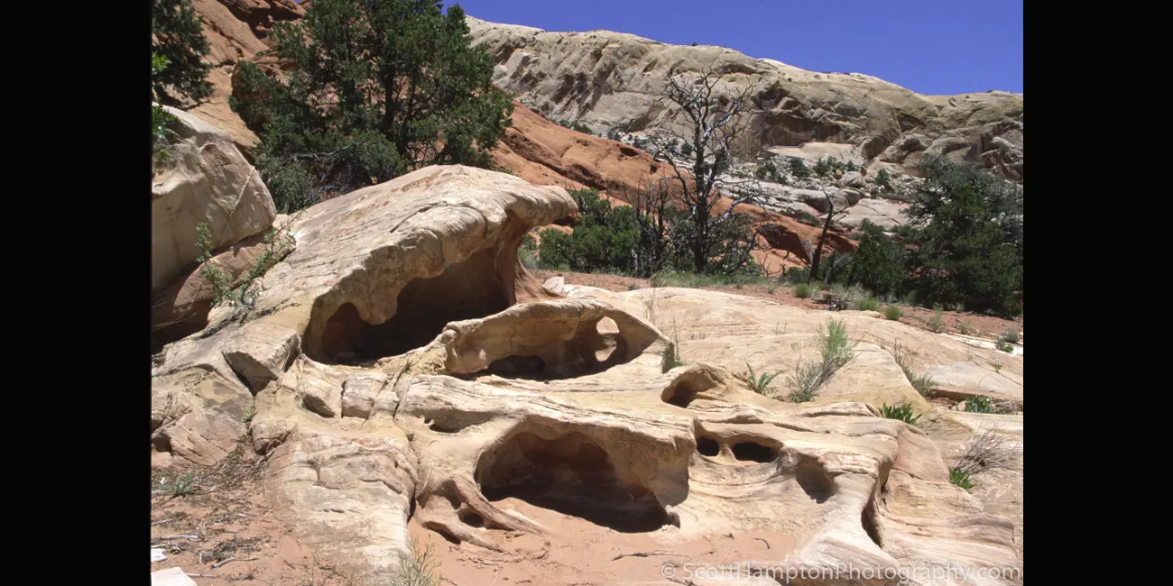
Burr Trail, Wave
The upper part looks like a giant wave is cresting or “going tubular “ as we used to call when I was a kid. I found this during my travels along the famous Burr Trail.
Dead Horse Point
From the prominence of Dead Horse Point, 2,000 feet above a gooseneck in the Colorado River, an ever-changing landscape unfurls. Immense vertical cliffs meet with canyons carved by ice, water, and wind creating a visual masterpiece. Plants and animals surviving on the edge of existence face many challenges of extreme conditions within this high desert environment.
Canyon Cactus
On my way to one of the prettiest vista points on the North rim of the Grand Canyon. I noticed this lovely view close to the Western section of the Tuckup Trail. It is a remote area that is only accessible using a high clearance vehicle.
The Tuckup Trail is a 100 mi long hiking trail on the North Rim of the Grand Canyon National Park, located in the U.S. state of Arizona. It extends from Toroweap Point to 150 Mile Canyon on the Esplanade member of the Supai formation. It originated as a cattle trail and many cowboy camps can be found along it's extent. It has few reliable water sources, Schmutz Spring at the head of Tuckup Canyon being one of them.
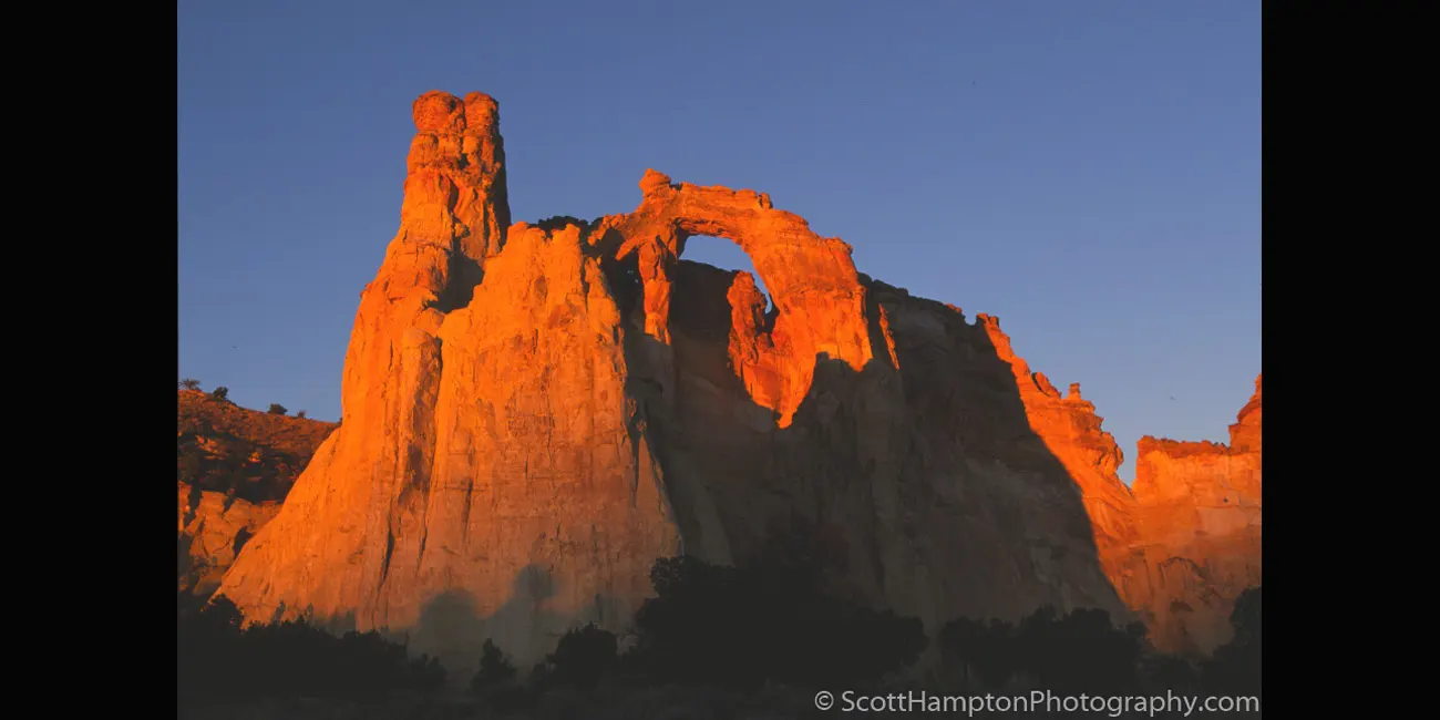
Grosvenor Arch
Grosvenor Arch is a unique sandstone double arch located within Grand Staircase-Escalante National Monument in Utah. It is named to honor Gilbert Hovey Grosvenor, a president of the National Geographic Society, publishers of the National Geographic Magazine.
Grosvenor Arch is actually two sandstone arches towering 150ft/45m above the ground. The largest arch is nearly 100ft/30m in diameter. You can walk right up under the arches and look up into the sky.
Cottonwood Canyon Road III
This is one of Utah's most beautiful and exciting ''back country'' roads to drive on. It is all dirt/gravel but you can traverse it with a 2WD high clearance vehicle. This road is best explored if you are willing to spent two or three days and do not mind ''primitive'' camping conditions.
Kodachrome Basin
Sixty-seven monolithic stone spires called sedimentary pipes accentuate multi-hued sandstone layers revealing 180 million years of geologic time. The color and beauty found here prompted a 1948 National Geographic Society expedition to name the area Kodachrome after the popular color film. Kodachrome Basin, as its name implies, is a spectacle of massive sandstone chimneys changing in color with the day's mood.
Kodachrome Basin I
Sixty-seven monolithic stone spires called sedimentary pipes accentuate multi-hued sandstone layers revealing 180 million years of geologic time. The color and beauty found here prompted a 1948 National Geographic Society expedition to name the area Kodachrome after the popular color film. Kodachrome Basin, as its name implies, is a spectacle of massive sandstone chimneys changing in color with the day's mood.
Kodachrome Basin II
Sixty-seven monolithic stone spires called sedimentary pipes accentuate multi-hued sandstone layers revealing 180 million years of geologic time. The color and beauty found here prompted a 1948 National Geographic Society expedition to name the area Kodachrome after the popular color film. Kodachrome Basin, as its name implies, is a spectacle of massive sandstone chimneys changing in color with the day's mood.
Kodachrome Basin III
Sixty-seven monolithic stone spires called sedimentary pipes accentuate multi-hued sandstone layers revealing 180 million years of geologic time. The color and beauty found here prompted a 1948 National Geographic Society expedition to name the area Kodachrome after the popular color film. Kodachrome Basin, as its name implies, is a spectacle of massive sandstone chimneys changing in color with the day's mood.
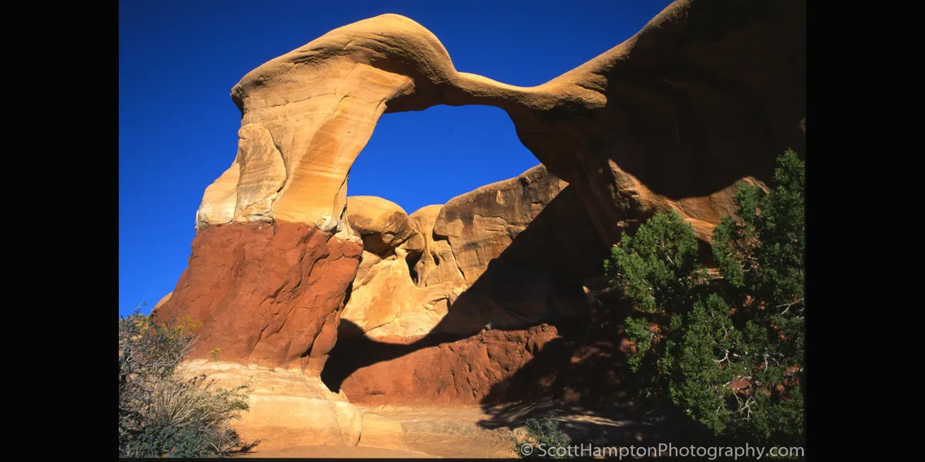
Arch at Devil's Garden
The Devils Garden of the Grand Staircase–Escalante National Monument in south central Utah, is a protected area featuring hoodoos, natural arches, and other sandstone formations. The United States Geological Survey (USGS) designated the name Devils Garden on December 31, 1979. The area is also known as the Devils Garden Outstanding Natural Area within the National Landscape Conservation System.
The formations in the Devils Garden were created, and continue to be shaped, by various weathering and erosional processes. These natural processes have been shaping sandstone layers formed more than 166 million years ago during the Jurassic period's Middle epoch.
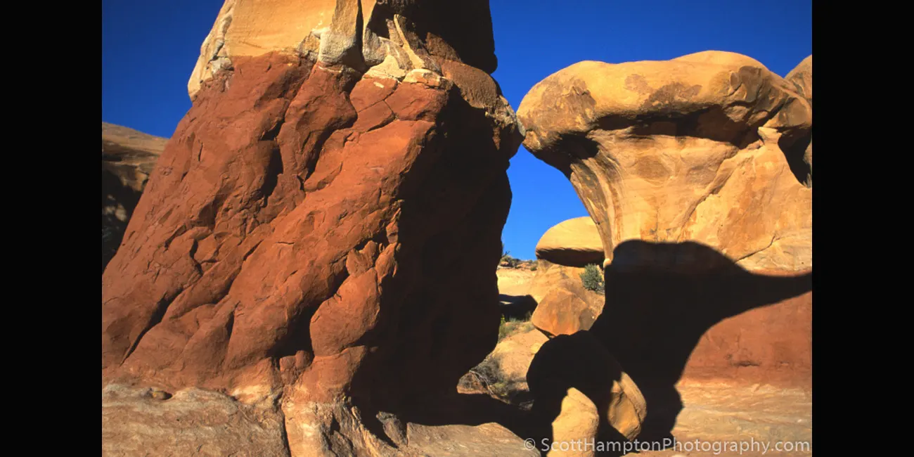
T-Rex in the Shadows
Looks like a dinosaur bending down to eat.
On the Road to Canyonlands
This is a capture that was near the main entrance to Canyonlands National Park near Moab, Utah. Hence, the title, On the Road to Canyonlands.
Colorado River flowing through the Canyonlands
Canyonlands National Park is a showcase of geology. In each of the park's districts, visitors can see the remarkable effects of millions of years of erosion on a landscape of sedimentary rock. Pictured above, the Colorado River has carved a channel out of rock layers deposited nearly 300 million years ago.
Colorado River with the
LaSalle Mountain Range
in the Background
XXXXXXXXXX
The "Windows" of Arches
This is the Windows area of Arches National Park with the La Sal Mountains in the background. From this vantage point you can only see two windows, one is close to the left edge, but the other is hard to see... the shadows will help.
The Windows Section is considered by some to be the beating heart of Arches National Park. The area contains a large concentration of arches and is one of the most scenic locations in the park. North Window, Turret Arch, and Double Arch are just a few of the awe-inspiring expanses you will find in just over two square miles. Other named features in this area include Garden of Eden, Elephant Butte, and Parade of Elephants.
Balanced Rock I
Balanced Rock at Arches National Park taken from a not so dramatic vantage point, however the skies were quite dramatic.
Balanced Rock II
Photograph of Balanced Rock taken from a more classic position.
Fremont River Home
Cannot really dig up any history on this structure but it is approximately 5 miles west of Hanksville, Utah on Hwy 24. It is located right buy the Fremont River (hence the name.)
XXXXXXXXXXXX
XXXXXXXXXXXXXXXXXXXXX
XXXXXXXXXXXX
XXXXXXXXXXXXXXXXXXXXX
XXXXXXXXXXXX
XXXXXXXXXXXXXXXXXXXXX
My name is Scott and this is my second major website revision for ScottHamptonPhotography.com. I am an IT pro but not a website designer. My old photography website was very ‘’static’’ looking and needed to be moved into the modern world. Luckily I was able to find an app that helped me move my website into the modern age! As a result, this site is currently in development and has minimal navigational (or any other) features at this time(November 2015.)


.webp)


