Below are some quick tips on how to navigate this website:
Click on Scott Hampton Photography (upper left) to get back to the Home
Page.
While on the Home Page you can cycle throught the thunbnails and select
the collection you want to view. You must then click/tab on the larger image above to
enter that particular collection.
Slideshow automatically rotates image approximately every five seconds. Alternatively, you can swipe, drag (mouse), and even use the arrows on your keyboard to cycle through the photographs and/or thumbnails.
You can click/tap on the photo to get a description.
Index
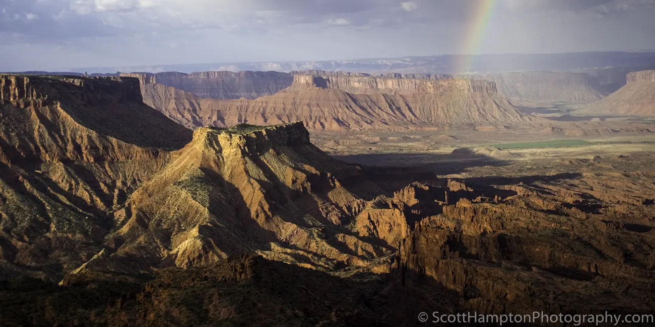
Cloudburst at the 'Top of the World'

The Straight and Narrow Road
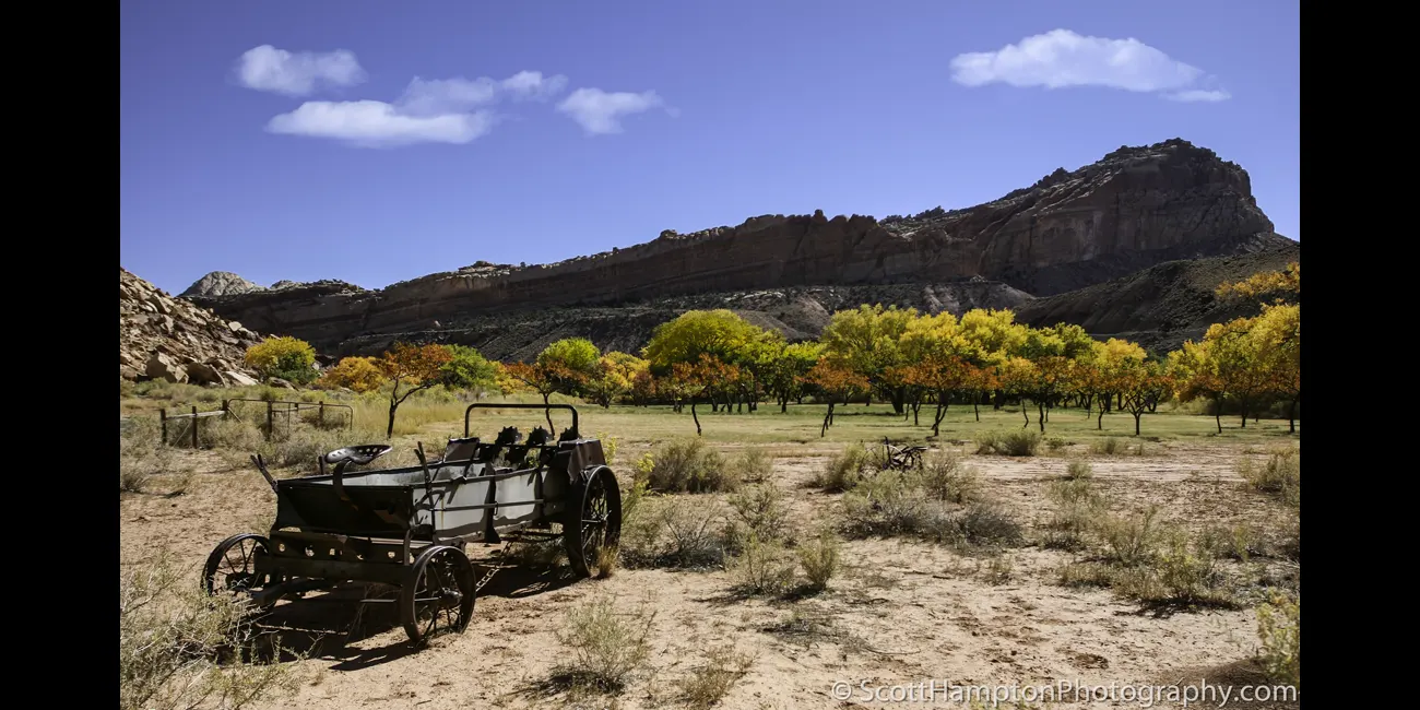
Rusty Tractor, Capital Reef

Upper Cathedral Valley, Capital Reef NP

Lake Powell Sunrise

Bullberry Inn

Swallows' Nest
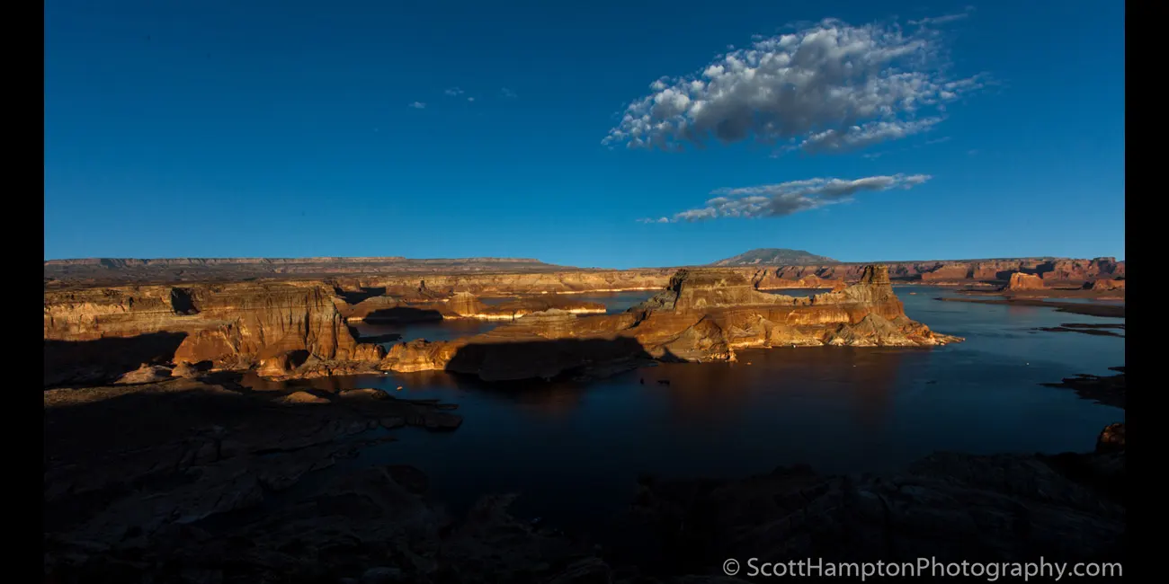
Lake Powell Sunset Looking East
Towards Gunsite Butte
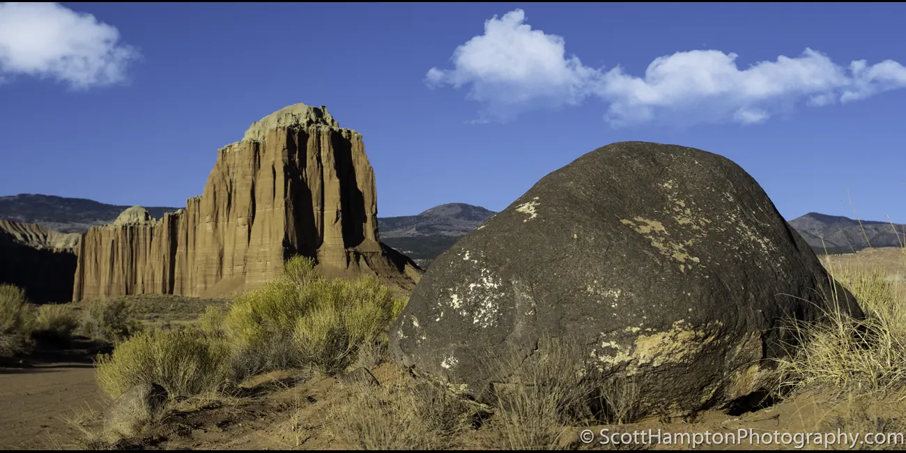
Dinosaur Egg

Sunset on Gunsite Butte

Mushroom Village at Goblin Valley

Goblin Valley

Snoopy at Goblin Valley

The Onlookers

Goblin Valley II

Goblin Valley III

Balanced Rock II, Arches National Park

Glenn Canyon Butte
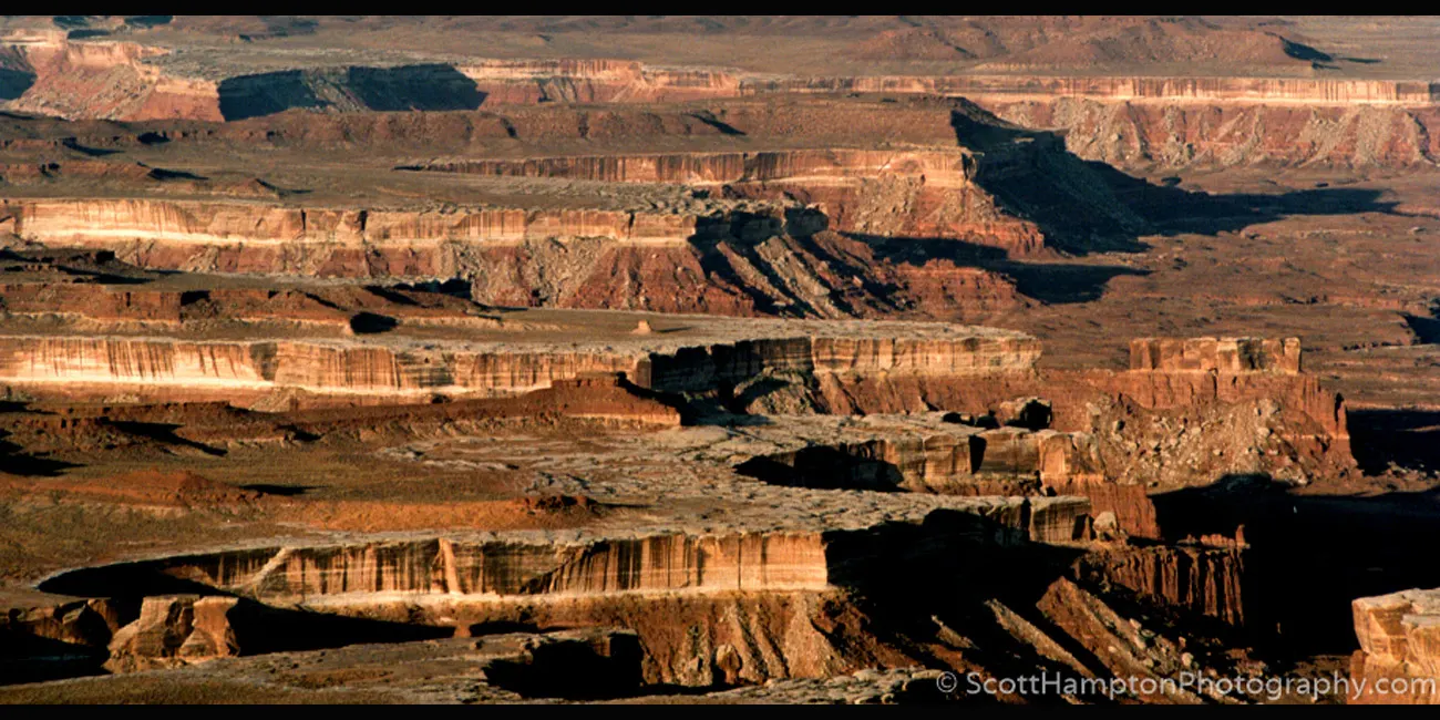
Canyonlands National Park

A Rock on a Hill
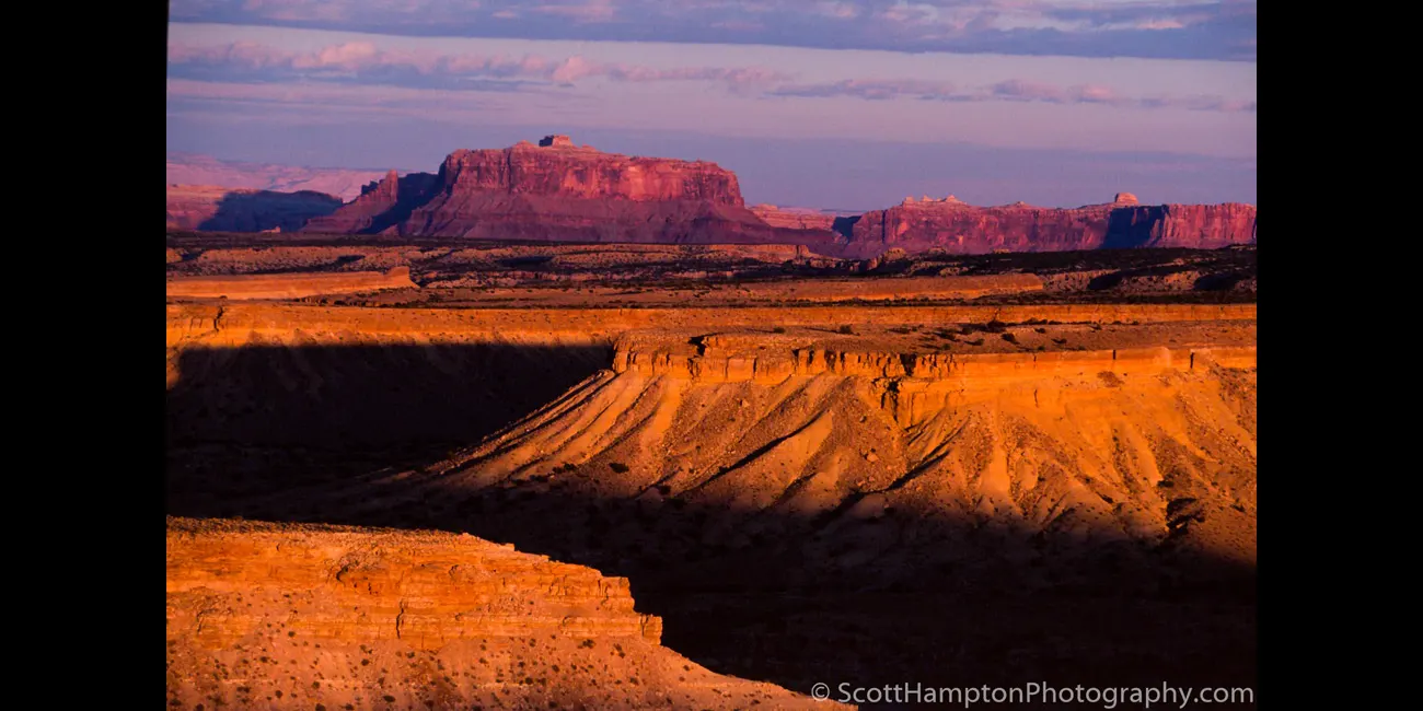
Black Box

Mount Hayden, Grand Canyon
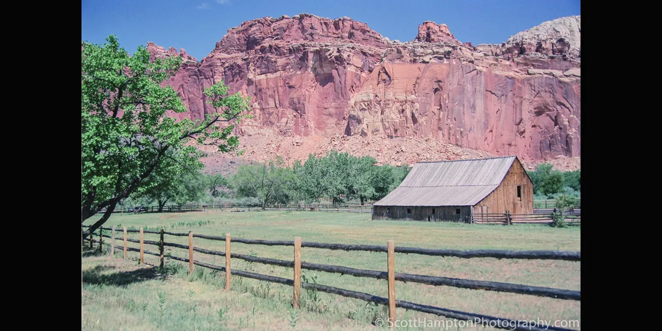
Barn, Capital Reef
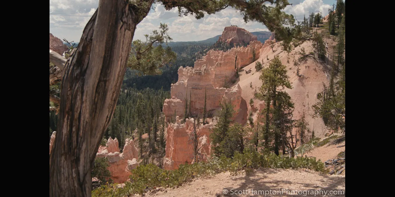
Bryce National Park
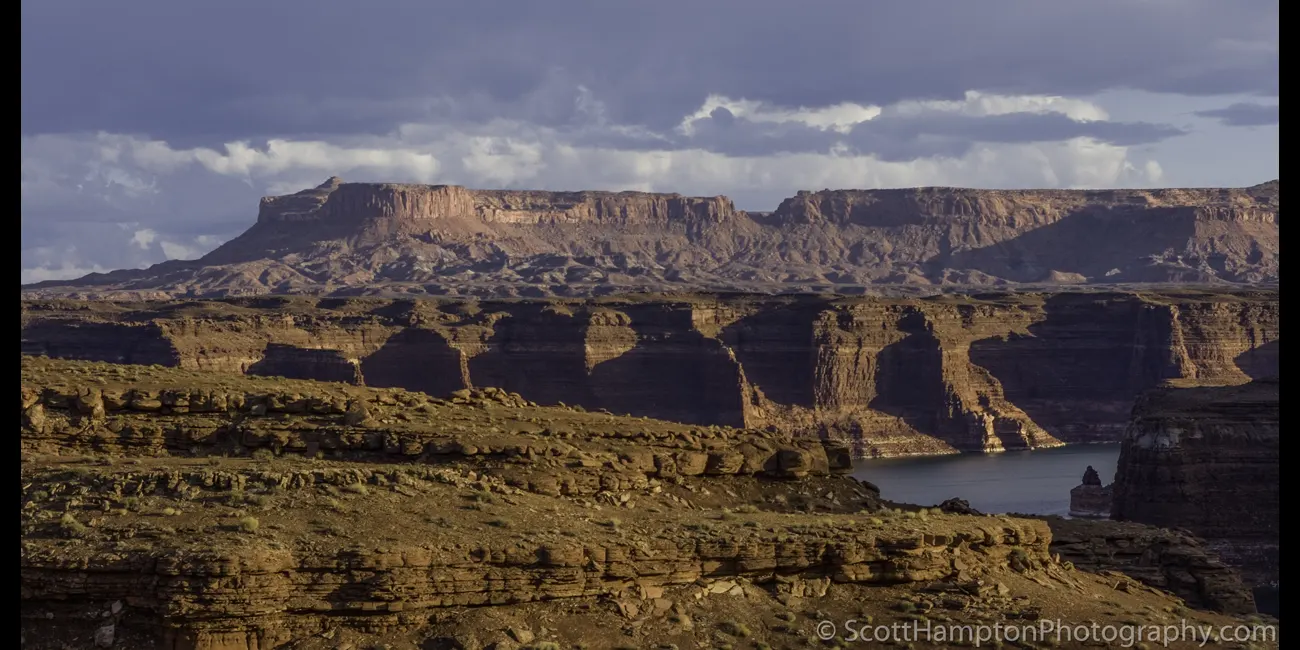
North Lake Powell

Swiss Cheese on the Burr Trail

Halls Creek Area Near Bullfrog

Rock Tower

Sunset on the Hite Bridge

A Meadow Near Buffalo Pass

Valley of the Gods

The White Ridges of Caineville

Farmland near the Upper Cathedral Valley

Glen Canyon Dam

Kolob Overlook on the Arizona Strip
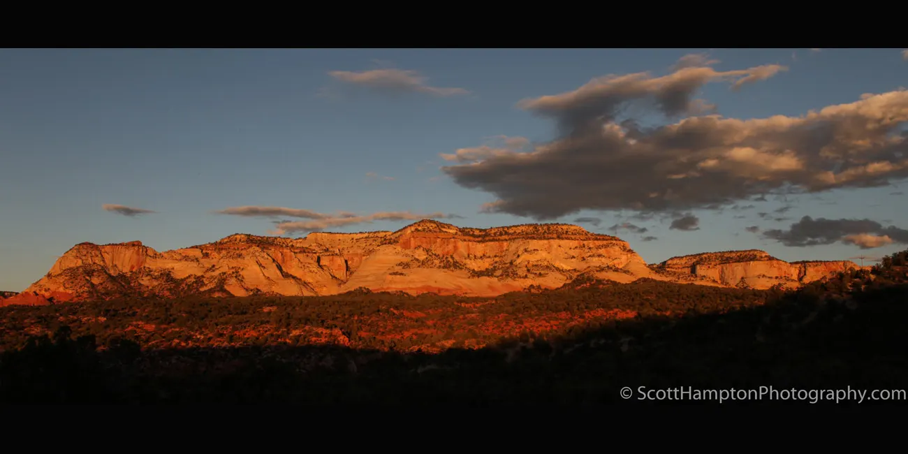
Near Mt. Carmel Junction

Hite Bridge in the Distance

Devil's Garden

Ridge near the La Sal Mountains

San Rafael Reef, Utah

Red Rocks

UFO

Hite Airport

Escalante Mountains

Upper Cathedral Valley, Capital Reef National Park

Goblin Valley IV

Valley of the Gods II

Bullfrog Bay (Lake Powell)
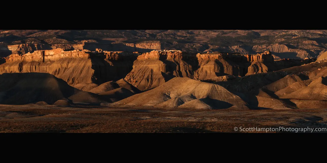
Eggnog

Fall Colors Near a Meadow

Upper Cathedral Valley II, Capital Reef NP

Upper Cathedral Valley II, Capital Reef NP

Zabriskie Point, Death Valley

Alpine Ceiling
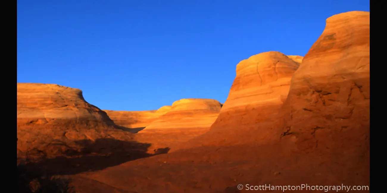
Sunset at Devil's Garden
San Rafael River, Buckhorn Wash

Sunset at Dewey Ranch

Arches Wall
Capital Reef National Park
Delicate Arch and Friends

Visiting Mars
Windows v2, Arches National Park
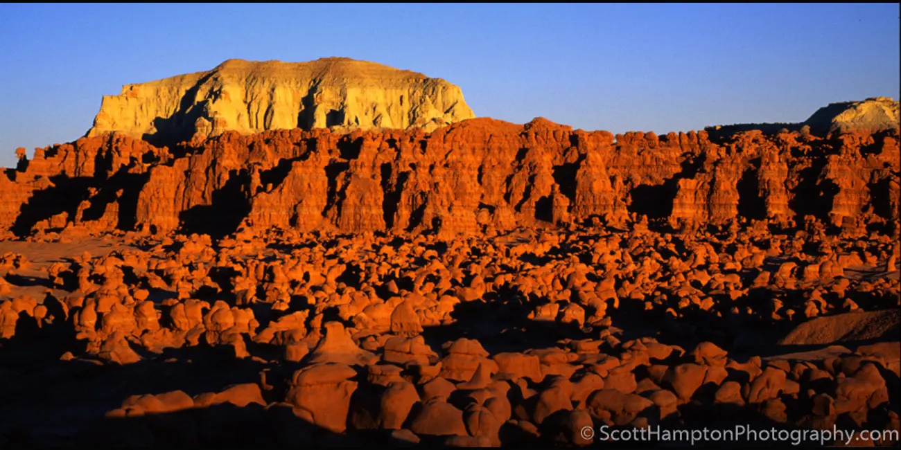
Mars II

Hunter Power Plant, Utah.... Flying Saucers

Hole in the Wall

The Walls of Mount Hillers

Pennell Creek Roughs

Coal Wash
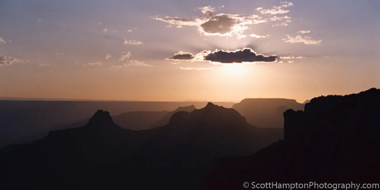
Sunset on the North Rim Grand Canyon

Lone Bolder

Sphinx Through the Window

The Trickle Down Effect

Nice Lighting on the Rock
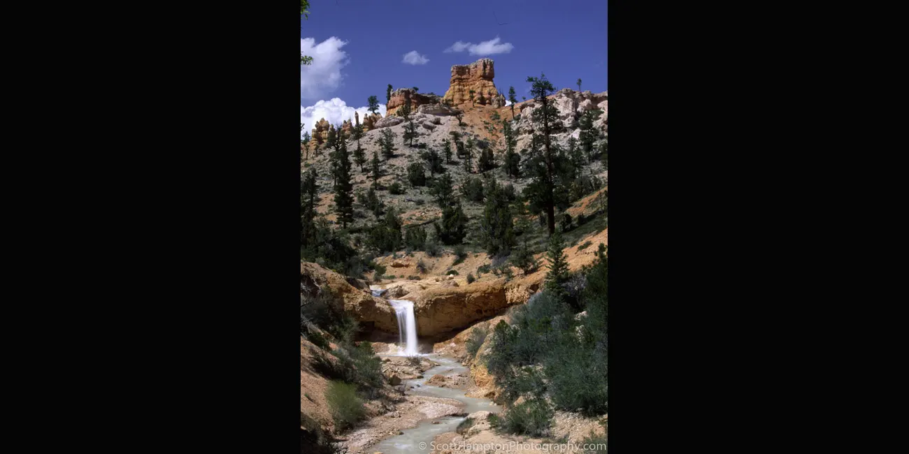
Mossy Cave Falls

This one is right off the
Burr Trail in
Glenn Canyon

One Paw Down,
Lake Powell area.

Goblin Podium in the Devil’s Garden

Swiss Cheese Along 95
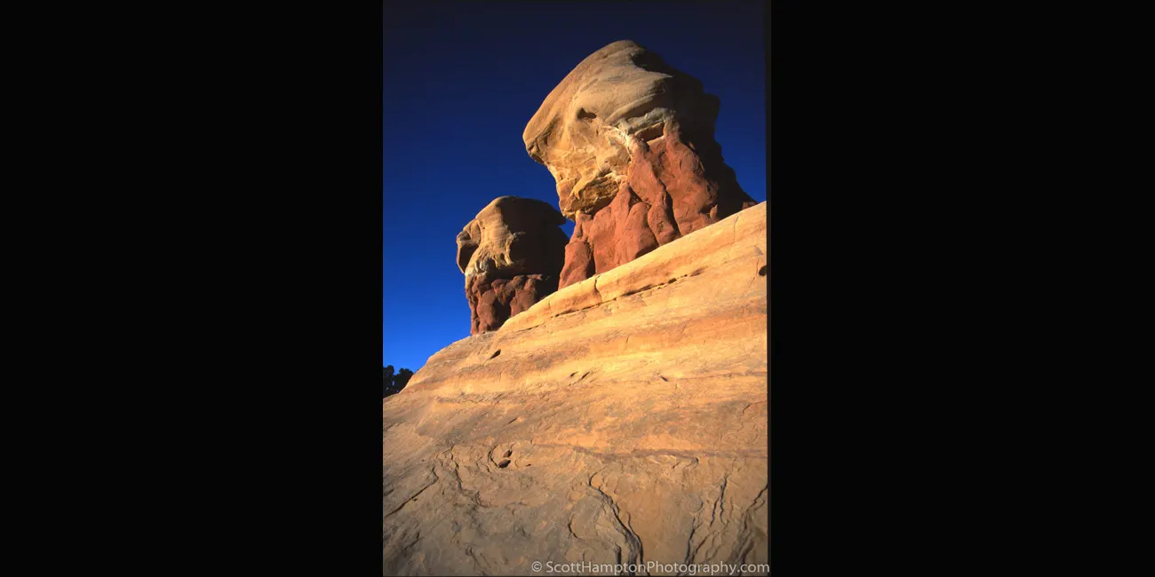
Leaning Over Devil's Garden
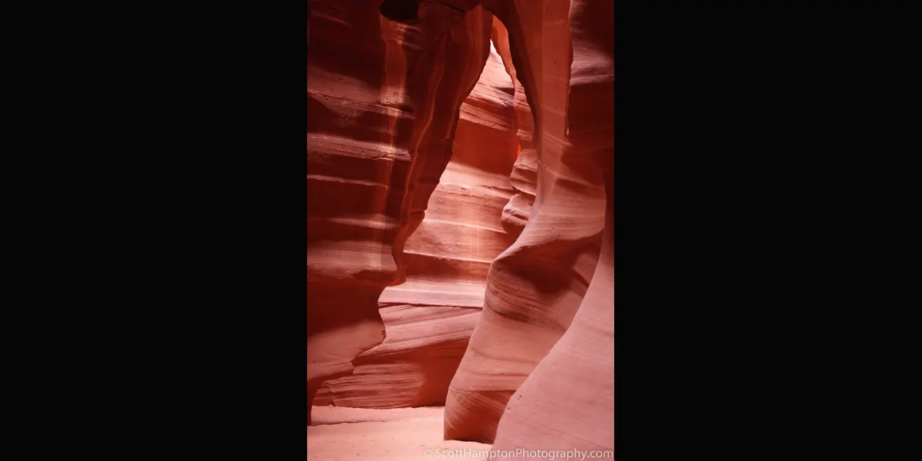
Antelope Canyon III

Antelope Canyon IV

Butte by Paria, Utah

Ghostly Supprise
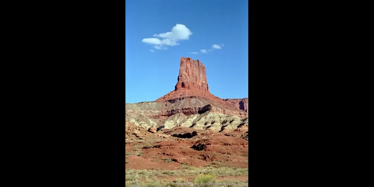
A Butte with No Name

Thank You!

Cloudburst at the 'Top of the World'
Took me over two hours to complete a 19-mile journey with an elevation gain of 3,287 feet. I had to get out of my Jeep a few times to rearrange rocks and create “stair steps.” The plan was to set up camp up here and take pictures at sunrise the next morning. Unfortunately, the terrain was so rough I could not find a place to pitch a tent. Furthermore, it was getting very windy as storms were starting to blow through, so I ended up sleeping in my Jeep. Luckily, I was treated to a nice sunrise and I even got a rainbow out of it.
The trail to this spot is mainly used by off-road drivers, some mountain bikers, and a few hikers. Trail starts out smooth gravel which is deceiving, it gets far more technical when you reach the split in the trail at the final stretch to the top. If it is a rainy day, do not attempt this drive unless you are expert off-roader and have a winch.
The Straight and Narrow Road
Been on this road a few times in my life. It is most famous for the ‘’straight line’’ the road created in this image. I got lucky on one of my visits to arrive here just after the road was repaved. Clearly the road is the main feature here but do not forget how beautiful the background is.
Rusty Tractor, Capital Reef
I like the colorful trees in the background. There were ten Mormon families that lived here and planted orchards of cherry, apricot, peach, pear, apple, plum, mulberry, almond, and walnut trees. They called this area Fruita.
Fruita is the center of activities and services at Capitol Reef National Park. The village is located on Utah State Route 24, about 10 miles east of Torrey and 36 miles west of Hanksville. Nestled in a beautiful canyon at the junction of the Fremont River and Sulphur Creek, Fruita was founded in the 1880s when Mormon pioneers settled there.
Upper Cathedral Valley
Upper Cathedral Valley, Capital Reef National Park, Arrived in the area early in the morning. Found this vantage point less than fifteen minutes before the sun fell behind the clouds for the evening. Unbelievability beautiful!! This is one of my favs mainly because of the clouds. Although I have taken many 'wide angle' shots here this particular image has been stitched together from 3 shots.
Lake Powell Sunrise
Lake Powell Sunrise Looking West. I captured this image less than 100 feet from my campsite. Of course, it was no accident that I was camping so close to here. The gray look below the bottom cloud layer is rain. Yes, I do get nervous... even 4x4s with big knobby tires cannot pass when wet because of the high clay content in the area. One cardinal rule is to always keep at least a weeks' worth of food and water with you when you visit these areas. Personally, I almost always have two weeks’ worth of supplies when traveling the backcountry.
Bullberry Inn
Found the Inn located in an area called Bryce Valley hence the BV you see on the side of the Hill. The Bullberry Inn is a family owned and operated Bed & Breakfast. It is nestled on the border of Bryce Canyon National Park, located on scenic Highway 12. The entrance to Bryce Canyon is a just 11 miles away.
Swallows' Nest
Another old home found near the Fremont River. Mancos Shale Mesa is in the background. I called it swallows nest because there must have been 10 or 20 swallows flying in and out of that door. Nice to see the home being repurposed!
Lake Powell Sunset Looking East Towards Gunsite Butte
This photograph was taken from Alstrom Point looking at Gunsight Butte. I sat there just watching this set of clouds crossing from left to right hoping it would not dissipate before it crossed to the right. I was not disappointed!
Dinosaur Egg
Just calling it a Dinosaur egg because it kind of resembles the shape, although a little big. Searched around and I could not find and do not think there is a name for the Butte that is in the background. It is in Capitol Reef National Park off of Cathedral Valley Road which is a 4x4 trail.
Sunset on Gunsite Butte
Gunsight Butte is a 4,678-foot summit located in Glen Canyon National Recreation Area, in southern Utah. It is situated 12 miles northeast of the town of Page, Arizona. Gunsight Butte is an island that towers nearly 1,000 feet above Lake Powell when the lake is full. Gunsight Butte is composed of Entrada Sandstone, which was originally deposited as sandy mud on a tidal flat, is believed to have formed about 160 million years ago during the Jurassic period as a giant sand sea, the largest in Earth's history.
Mushroom Village at Goblin Valley
Clearly, these hoodoos look like mushrooms. These “mushrooms” are in Goblin Valley State Park located in southern Utah. The park features thousands of hoodoos, referred to locally as goblins, which are formations of mushroom-shaped rock pinnacles, some as tall as several yards. The distinct shapes of these rocks result from an erosion-resistant layer of rock atop relatively softer sandstone.
Goblin Valley Sunrise
Much of Goblin Valley comprises of hoodoos that look like mushrooms, however, these kind of remind me of something else.
Snoopy at Goblin Valley
Looks like snoopy to me, just use a little imagination… might need a lot of imagination
The Onlookers
Lots of hoodoos keeping an eye on things.
Goblin Valley II
The park features thousands of hoodoos, referred to locally as goblins, which are formations of mushroom-shaped rock pinnacles, some as tall as several yards. The distinct shapes of these rocks result from an erosion-resistant layer of rock atop relatively softer sandstone.
Goblin Valley III
The park features thousands of hoodoos, referred to locally as goblins, which are formations of mushroom-shaped rock pinnacles, some as tall as several yards. The distinct shapes of these rocks result from an erosion-resistant layer of rock atop relatively softer sandstone.
Balanced Rock II, Arches National Park
Balanced Rock is one of the most popular features of Arches National Park in Southern Utah. Balanced Rock is located next to the park's main road, at about nine miles from the park entrance. It is one of only a few prominent features clearly visible from the road.
The total height of Balanced Rock is 128 feet, with the balancing rock rising 55 feet above the base. This rock is the largest of its kind in the park, weighing in at around 3,577 tons.
Glenn Canyon Butte
I was exploring the 4x4 trails in the Hite area of Glenn Canyon while trying to find a spot that might let the sun peek through. You see it was a very stormy day and by this time the sky was overcast and gray. Being a landscape photographer, I am not a real fan of gray skies and the sun was going to set fairly soon. I looked to the south and notice the sunlight off into the distance. I hopped into my Jeep and drove south on Utah Hwy 95. After about ten miles I began to see the light as I entered this amazing area with large puffy clouds and colorful light dancing along the desert floor. Much to my delight I realized I had met the storms' edge. So I decided to get off the main road (Hwy 95) and explore the backcountry. Much to my delight I found this place soon before the sun was to set. Although I was disappointed these amazing clouds were not near my focus for this evening (the Hite Crossing Bridge.) I was still rewarded with the wonderful show that nature decided to provide for me here!
Canyonlands National Park
I loved visiting Canyonlands and Arches National Park for many years! I can't begin to count how many enjoyable memories I've had when visiting these parks back in the turn of the last century! However, in the past several years I have done an explosive amount of scouting using Flickr, Google Earth, and other Internet resources. This ''scouting'' has led me to discover many other photographic possibilities in the past few years. I am thankful for all the information the Internet has given me but it sometimes leaves me yearning for the ''old days.'' So occasionally I find myself roaming through some of my old film archives in search of some ''noteable'' frames I might have missed in the past. Well, as you have guessed, this is one of them!
A Rock on a Hill
Hold on folks, it does not get more exciting than this... A Rock On A Hill!!! One could say it is a rock on a pile of dirt😊 Think it works if you are a “minimalist.”
I captured this in the Glen Canyon national recreation area just off Warm Creek Road which is a 4x4 trail.
Black Box
This is an area called the black box located in an area called the San Rafael Swell in southern Utah. This area is very popular with canyoners, however, it is also a very risky area subject to frequent flooding.
Mount Hayden, Grand Canyon
Mount Hayden is an 8,362-foot-elevation summit located in the Grand Canyon. It is situated one-half mile southeast of the Point Imperial viewpoint, on the canyon's North Rim, where it towers 5,000 feet above the bottom of Nankoweap Canyon.
Barn, Capital Reef
The Gifford Homestead is a historical farmhouse that is just past the welcome center of Capitol Reef National Park. This landmark is a living museum that describes the pioneer history of the Mormons who settled this land. Settlers planted fruit trees and named the town “Fruita” for them. Now these groves are part of a National Park, so the town hosts no permanent residents. The trees remain, and the historic Homestead celebrates their existence by serving a wide variety of fruit pies.
Bryce National Park
Bryce Canyon National Park is located in southwestern Utah. The major feature of the park is Bryce Canyon, which despite its name, is not a canyon, but a collection of giant natural amphitheaters along the eastern side of the Paunsaugunt Plateau. Bryce is distinctive due to geological structures called hoodoos, formed by frost weathering and stream erosion of the river and lake bed sedimentary rocks.
North Lake Powell
A Canyon area located around northern part of Lake Powell can catch a glimpse of the lake towards the right.
Swiss Cheese on the Burr Trail
I guess you can see why I called this Swiss cheese.
Halls Creek Area Near Bullfrog
This area is popular due to the closeness of Bullfrog and Halls Crossing Marinas. Halls Creek Bay, 93 miles above Glen Canyon Dam, has many small side canyons entering the Waterpocket Fold. The entrance to Halls Creek Bay is misleading as it is one of the few canyons that will get wider after you go through the mouth. There are many good campsites around here and I will be enjoying one myself.
Rock Tower
Taken at the busy intersection of warm Creek Road, missing Canyon Road, and Recreation Road 230. By the way, don't try to get to this busy intersection without using a 4x4.
Sunset on the Hite Bridge
Sunset on the Hite Bridge. The bridge is the only automobile bridge spanning the Colorado River between the Glen Canyon Bridge, 185 miles downstream near the Glen Canyon Dam and the U.S. Route 191 bridge 110 miles upstream near Moab. This photograph was taken at the south end of a small airstrip.
A Meadow Near Buffalo Pass
Looks like somebody's hunting lodge next to a Meadow near Buffalo Pass in Colorado. it is also the location of the continental divide. For those who do not know the continental divide is the separator where water flows to either the Pacific Ocean or the Atlantic Ocean. Continental divide extends from the north of Alaska all the way down to the south tip of South America.
Valley of the Gods
The Valley of the Gods is a scenic sandstone valley near Mexican Hat in southeastern Utah. Valley of the Gods is located north of Monument Valley across the San Juan River and has rock formations similar to those in Monument Valley with tall, reddish brown mesas, buttes, towers and mushroom rocks, remnants of an ancient landscape.
The White Ridges of Caineville
Ekker Butte is a 6,260-foot summit located in the northern reach of Glen Canyon National Recreation Area located in Caineville, Utah. Ekker Butte towers over 1,400 above the surrounding terrain. This geological landmark is named for the pioneering Art Ekker family which operated the nearby Robbers Roost Ranch and grazed cattle on land adjacent to the nearby Maze. Robbers Roost was the hideout of outlaw Butch Cassidy and the Wild Bunch.
Farmland near the Upper Cathedral Valley
This area is called the Caineville Wash that was created by the Fremont River. As humans typically do, it is exploited it for the rich farmland it created. This farm is 25 miles west of Robbers Roost which was Butch Cassidy's hideout.
Glen Canyon Dam
This is the dam that created Lake Powell. It is located just west of Page, Arizona. This dam also has a hydro-electric plant that supplies Page with its electricity. These are two completely different structures (dam and bridge) yet both are using the same (and one of the oldest) engineering principles to maintain their integrity... that would be an arch. Arches were first recognized in structures built around 2,000 BC.
Kolob Overlook on the Arizona Strip
I was walking down this short trail just hoping I could find a good foreground to support this beautiful background. I could not believe I ran into this ''disc'' looking rock sticking up from the ground.
Near Mt. Carmel Junction
I could tell by the light that there was going to be a little color in tonight's sunset. I was still looking for a place to camp when I found this spot. I would have liked to find some good foreground, but I was running out of time. As a result, it is defiantly not my greatest shot, but I got some good color on the rocks.
Hite Bridge in the Distance
The Hite Crossing Bridge is an arch bridge that carries Utah State Route 95 across the Colorado River northwest of Blanding, Utah. The bridge informally marks the upstream limit of Lake Powell and the end of Cataract Canyon of the Colorado River, but when the lake is at normal water elevation, the water can back up over 30 miles upstream into Cataract Canyon. The bridge is the only automobile bridge spanning the Colorado River between the Glen Canyon Bridge, 185 miles downstream near the Glen Canyon Dam and the U.S. Route 191 bridge 110 miles upstream near Moab. The bridge is near Hite Marina on Lake Powell, and a small airstrip is immediately adjacent to the north side of the bridge.
Devil's Garden
The Devils Garden of the Grand Staircase–Escalante National Monument in south central Utah, is a protected area featuring hoodoos, natural arches, and other sandstone formations. The United States Geological Survey (USGS) designated the name Devils Garden on December 31, 1979. The area is also known as the Devils Garden Outstanding Natural Area within the National Landscape Conservation System.
Ridge near the La Sal Mountains
Pretty Scene near Cannonville, Utah. I looked on all my maps but I could not find the name for this butte, but I still think it is picture worthy.
San Rafael Reef, Utah
The San Rafael Reef is a geologic feature located in Emery County in central Utah, part of the Colorado Plateau. Approximately 75 miles long, it is the name given to the distinctive eastern edge of the San Rafael Swell. Composed primarily of steeply tilted layers of Navajo and Wingate Sandstone, it has been eroded into tall fins, domes, cliffs, and deep canyons.
You can look at these layers and see are about 70 degrees perpendicular to the valley floor (Earth.) One could only imagine the forces that would have created this.
Red Rocks
Found these nicely colored rocks lying in front of a part of the San Rafael Reef.
The San Rafael Reef is a geologic feature located in Emery County in central Utah, part of the Colorado Plateau. Approximately 75 miles long, it is the name given to the distinctive eastern edge of the San Rafael Swell. Composed primarily of steeply tilted layers of Navajo and Wingate Sandstone, it has been eroded into tall fins, domes, cliffs, and deep canyons.
UFO
You are going to have to use a little bit of imagination here. The cloud on the left looks a little like a “U”, and the cloud in the middle looks like an “F”. Now this is where you really must use your imagination, but I have decided the cloud on the right looks like an “O” 😊
Hite Airport
I remember the first time visiting here I saw what I thought was an airplane taking off. Here I am making my around a canyon and thinking there is no way I actually saw an airplane taking off over a canyon ledge! Well as I approached the area I noticed an orange sock blowing in the wind. I noticed a dirt driveway close by so I naturally had to take a gander. Sure enough before me is a paved runway strip that I could have easily driven onto. Not only did the runway have a slight turn but it also has what seems to be is about a five-degree slope. By the way, I seen some dirt “bush” runways in the area that make this look like an international airport.
Escalante Mountains
Just the beginning of an off-road trip and the sun was starting to set so I decided to camp here for the evening. Besides, not a bad view to wake up to in the morning😊
Upper Cathedral Valley, Capital Reef National Park
Upper Cathedral Valley, Capital Reef National Park, arrived in the area early in the morning. This area is in the Fishlake National Forest. I was able to descend into the valley later that day.
Goblin Valley IV
Journey to this strange and colorful valley, which is unlike any other in Utah. The landscape, covered with sandstone goblins and formations, is often compared to Mars. Explore the geology, and camp among the nooks and gnomes.
Valley of the Gods II
The Valley of the Gods is a scenic sandstone valley near Mexican Hat in southeastern Utah. Formerly part of Bears Ears National Monument, Valley of the Gods is located north of Monument Valley across the San Juan River and has rock formations similar to those in Monument Valley with tall, reddish brown mesas, buttes, towers and mushroom rocks, remnants of an ancient landscape.
Bullfrog Bay (Lake Powell)
Bullfrog Bay near Halls Creek. You can see Bullfrog Bay off to the right. Bullfrog Bay is part of the Lake Powell system. I remember as a kid my parents rented a houseboat from here. We toured all of Lake Powell, it was a very fun couple of weeks!
Eggnog
This is an area called Eggnog which is a few miles off the Burr Trail near Capital Reef. It seems like over the years Capital Reef is becoming my favorite area in Southern Utah. There are lots of 4x4 trails which is very helpful for someone like me who has some mobility issues. It is incredibly beautiful, and it's also one of the less popular national parks in the area (i.e. less people.) But let us not take anything away from that because it is up against some very tough competition like Bryce, Zion, Arches, and Canyonlands National Park. Let us face it. Southern Utah is one of the most beautiful places on this planet. It is changed me from being a mountain person to a desert person!
Fall Colors Near a Meadow
Fall color by a meadow near Buffalo Pass in Colorado. it is also the location of the continental divide. For those who do not know the continental divide is the separator where water flows to either the Pacific Ocean or the Atlantic Ocean. Continental divide extends from the north of Alaska all the way down to the south tip of South America.
Upper Cathedral Valley, Capital Reef National Park
Arrived in the area early in the morning. Found this vantage point less than fifteen minutes before the sun fell behind the clouds for the evening. Unbelievability beautiful!! This is one of my favs mainly because of the clouds. Although I have taken many 'wide angle' shots here this particular image has been stitched together from 3 tighter shots.
Zabriskie Point, Death Valley
Death Valley, Zabriskie Point. The Toes of Time are Reaching Out!
Zabriskie Point is a part of the Amargosa Range located east of Death Valley in Death Valley National Park in California, United States, noted for its erosional landscape. It is composed of sediments from Furnace Creek Lake, which dried up 5 million years ago—long before Death Valley came into existence.
Alpine Ceiling
Alpine trees near Blue Spring Mountain in the Dixie National Forest located in southern Utah.
Sunset at Devil's Garden
The Devils Garden of the Grand Staircase–Escalante National Monument in south central Utah, is a protected area featuring hoodoos, natural arches, and other sandstone formations. The United States Geological Survey (USGS) designated the name Devils Garden on December 31, 1979. The area is also known as the Devils Garden Outstanding Natural Area within the National Landscape Conservation System.
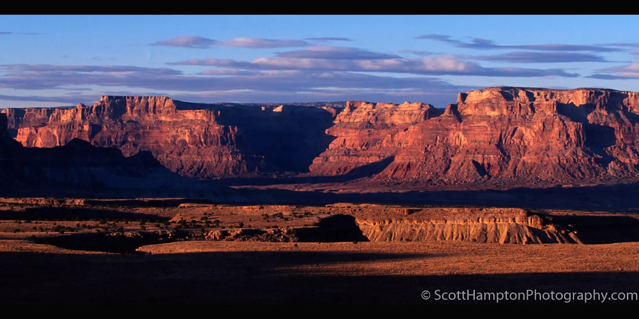
San Rafael River, Buckhorn Wash
Buckhorn Wash is in the San Rafael Swell in central Utah. I came through this area on my way to Buckhorn Wash to look at the petroglyphs (a.k.a. Rain Angels.)
Sunset at Dewey Ranch
I called it the Dewey ranch because it is in the town of Dewey, Utah. It is also home to the longest wooden suspension bridge in Utah. Unfortunately, the suspension bridge is in complete disrepair but there has been talk about restoring it.
Arches Wall
The beautiful cloud formations above are what attracted me to this picture. This “wall” is located right next to the world-famous Balanced Rock located in Arches National Park, Utah. The “wall” is comprised of server different rocks such as Ham Rock and Harkonnen Castle.
Capital Reef National Park
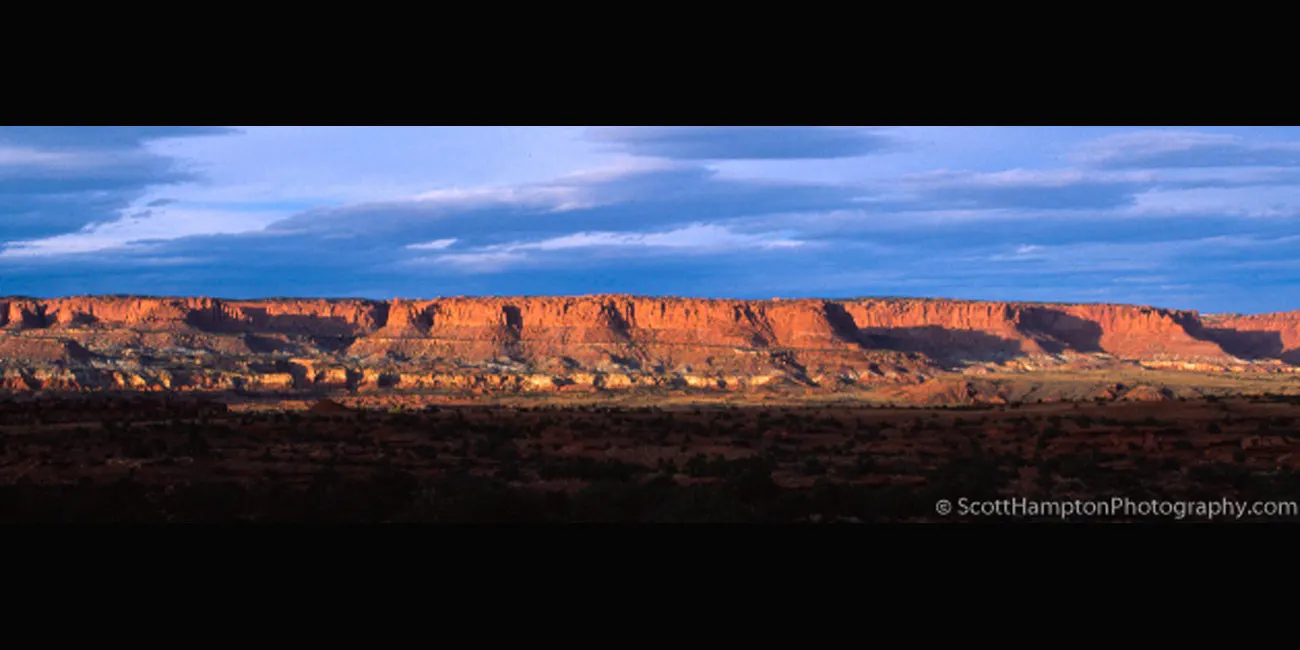
Just East of a town called Torrey, Utah is the western face of Capitol Reef National Park.
Delicate Arch and Friends
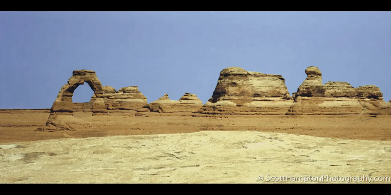
Delicate arch is one of the most iconic photographs in arches National Park. However, this is from a completely different perspective and not even close to that “iconic” look.
Visiting Mars
Only kidding, I was not really on Mars taking pictures. This area is called The Valley of the Goblins located at Goblin Valley State Park, Utah.
Windows v2, Arches National Park
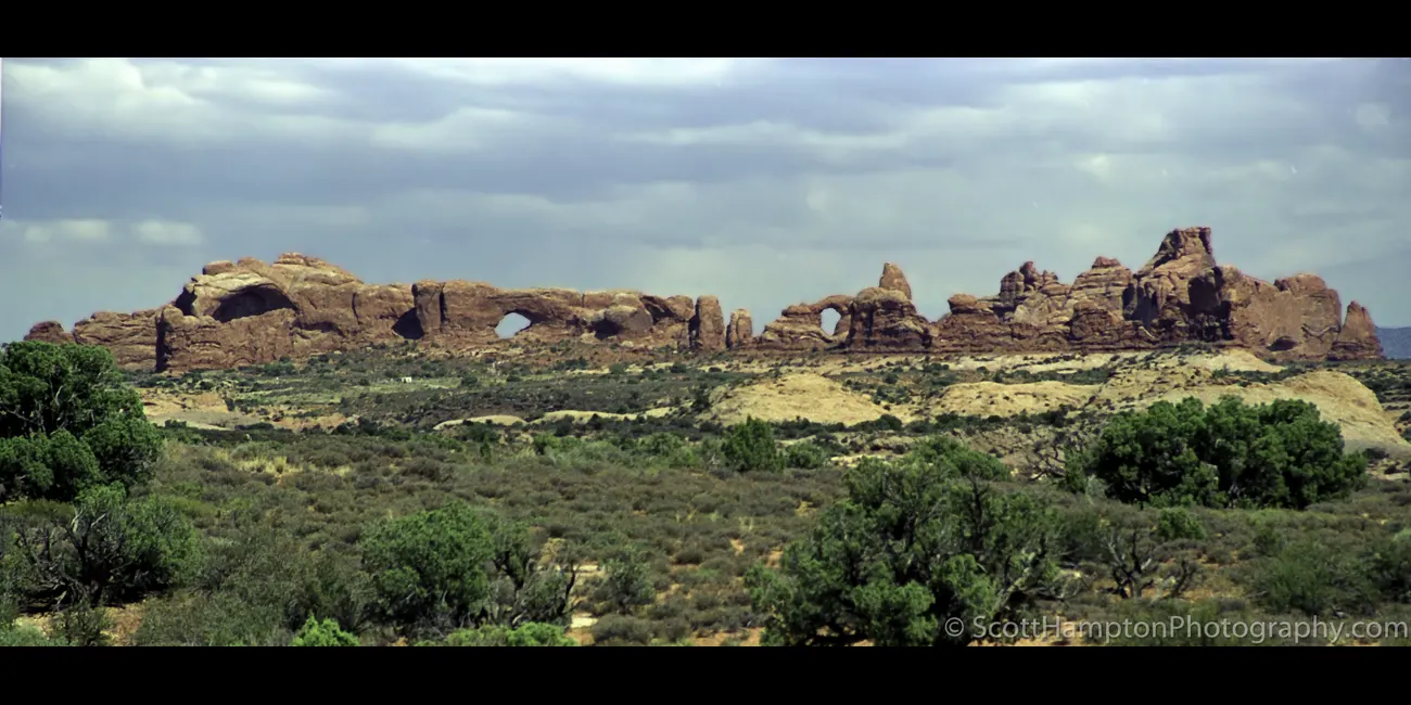
Not the most exciting photograph this depicts the windows section of Arches National Park.
Mars II
The different colored sandstone combined with the sunset made this a picture that is out of this world😊
Hunter Power Plant, Utah.... Flying Saucers
Hunter Power Plant is a 1,577.2-megawatt (MW) coal-fired power station near Castle Dale, Utah. Almost looks like the exhaust from the pipes are creating the flying saucer like clouds.
The Walls of Mount Hillers
Mount Hillers are on the left (obviously) and these wonderful rock formations on the right are very thin and tall creating what I call a wall.
Hole in the Wall
I cannot find any information for this particular formation. I see a hole in the wall so that is what I think I will call it: Hole in the Wall. This formation is located in an area called Andy Miller Flats.
Andy Miller Flats is adjacent to and north of the Mille Crag Bend of the Colorado River, five miles east of the mouth of the Dirty Devil River. Andy Miller was an early sheepherder who ran his sheep in the area.
Pennell Creek Roughs
Mt Pennell in the background. Pennell Creek Roughs in the foreground.
Coal Wash
I was headed west on US I-70 in Utah. Running in and out of so many storms for the last hour. I finally found a break but realized I was not going to have time to capture any close-ups. The safer thing was to do was to get up on a little Hill and capture a panoramic view.
Sunset on the North Rim Grand Canyon
My first artistic/canyon photo taken back in 1994 using real film!!
Lone Bolder
Unfortunately, I forgot to turn my GPS on this day and do not know exactly where this photo is. It is along a Entrada Ranch Road near Moab, Utah.
Sphinx Through the Window
Looks like it was somebody's home some time ago. I lined the window up to get this formation that looks like a Spinks (Temple Mountain.) This used to be a mining area for uranium. I remember talking to some guy close by here who had a Geiger counter.
Temple Mountain is a remote 6,820-foot summit located on the southeast flank of the San Rafael Swell in Utah. It was so named because the outline of this feature resembles the Salt Lake Temple in Salt Lake City. Although I still think it looks like a Sphinx. Towering 1,200 feet above its surrounding terrain, it is the highest point along the San Rafael Reef, and prominently visible from long distances.
This mountain is composed of bleached, almost white Wingate Sandstone, which is the remains of wind-borne sand dunes deposited approximately 200 million years ago in the Late Triassic
The Trickle-Down Effect
Wandering up and down the 4x4 trails in Glen Canyon National Recreation Area and here I am on warm Creek Rd when I ran into this very interesting hydrolyzation feature. This little wash had some water trickling down from the rainstorm that passed through a few days ago.
Nice Lighting on the Rock
I really wanted a good way of capturing the background, so I got desperate and used this rock as a subject.
Mossy Cave Falls
Mossy Cave and the waterfall near the cave makes an excellent roadside attraction on the east side of Bryce Canyon National Park. It is popular. A short hike leads to a photographer's paradise. The ease and length of this outing make it a good family friendly stop to stretch legs while passing near Bryce.
This one is right off the Burr Trail in Glenn Canyon
I like the way the cracks lead you up to the top of the butte.
One Paw Down
One Paw Down, Lake Powell area. I started playing with wishing I had my 17mm lens with me on this discovery.
Goblin Podium in the Devil’s Garden/div>
The Devils Garden of the Grand Staircase–Escalante National Monument in south central Utah, is a protected area featuring hoodoos, natural arches, and other sandstone formations. The United States Geological Survey (USGS) designated the name Devils Garden on December 31, 1979. The area is also known as the Devils Garden Outstanding Natural Area within the National Landscape Conservation System.
The formations in the Devils Garden were created, and continue to be shaped, by various weathering and erosional processes. These natural processes have been shaping sandstone layers formed more than 166 million years ago during the Jurassic period's Middle epoch.
Swiss Cheese Along 95
Love to capture this right after rain. Perhaps long exposure could produce some really spectacular scenes. Hope it rains soon😊 This ranks in a long Utah 95 in near Hog Canyon. There is probably a couple 1000 feet of this
Leaning Over Devil's Garden
Looks like these two pedestals do not have long to go before they fall.
The Devils Garden of the Grand Staircase–Escalante National Monument in south central Utah, is a protected area featuring hoodoos, natural arches, and other sandstone formations. The United States Geological Survey (USGS) designated the name Devils Garden on December 31, 1979. The area is also known as the Devils Garden Outstanding Natural Area within the National Landscape Conservation System.
The formations in the Devils Garden were created, and continue to be shaped, by various weathering and erosional processes. These natural processes have been shaping sandstone layers formed more than 166 million years ago during the Jurassic period's Middle epoch.
Antelope Canyon II
A major attraction made popular because of photography. Ironically, it is almost impossible to capture a good long exposure because there are too many people walking through. If I understand correctly there are no more photography tours because the park officials feel it is slowing down all the tours they feed through this place.
Butte by Paria, Utah
This place is a place called Pahreah (a.k.a. Paria), Utah. This site was home to an old town settlement most active throughout the 1870s. Unfortunately, regular flash flooding eventually drove the residents away. Later this turned into a filming location that featured movies like Clint Eastwood’s The Outlaw Joey Wales and TV shows like Gunsmoke that were filmed here in the 1960s.
Sadly, the set(s) were ultimately destroyed by an arsonist in 2006, but the area continues to provide some opportunities for photography. I happened to arrive just a few months after this unfortunate incident (OCT 3, 2006.) So no old movie sets in my foreground☹
Ghostly Supprise
Looks like a ghost to me. Right by Utah State highway 95 in Hogwarts Canyon, Glen Canyon National Recreation Area.
A Butte with no Name
I forgot to turn my on my GPS today so I could not find exactly exactly where this butte is located. All the colors with a couple of puffy clouds above is what attracted me to this shot.
XXXXXXXXXXXX
XXXXXXXXXXXXXXXXXXXXX
My name is Scott and this is my second major website revision for ScottHamptonPhotography.com. I am an IT pro but not a website designer. My old photography website was very ‘’static’’ looking and needed to be moved into the modern world. Luckily I was able to find an app that helped me move my website into the modern age! As a result, this site is currently in development and has minimal navigational (or any other) features at this time(November 2015.)


