Below are some quick tips on how to navigate this website:
Click on Scott Hampton Photography (upper left) to get back to the Home
Page.
While on the Home Page you can cycle throught the thunbnails and select
the collection you want to view. You must then click/tab on the larger image above to
enter that particular collection.
Slideshow automatically rotates image approximately every five seconds. Alternatively, you can swipe, drag (mouse), and even use the arrows on your keyboard to cycle through the photographs and/or thumbnails.
You can click/tap on the photo to get a description.
Index
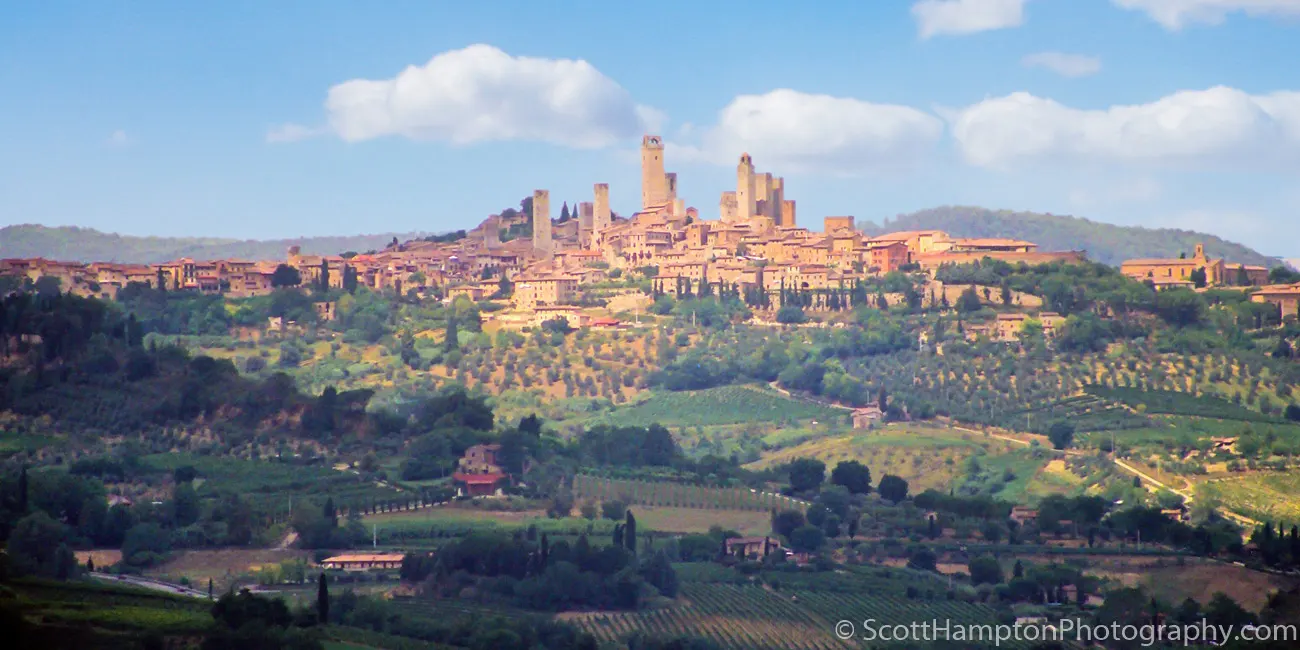
San Gimignano, Italia
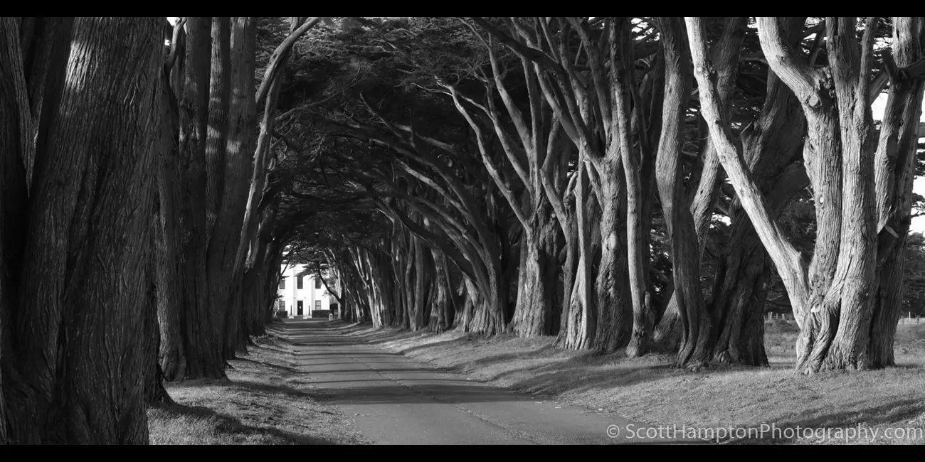
Point Reyes, Swooping Cypress
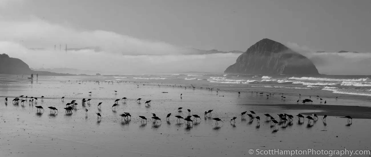
Morro Bay Aviary
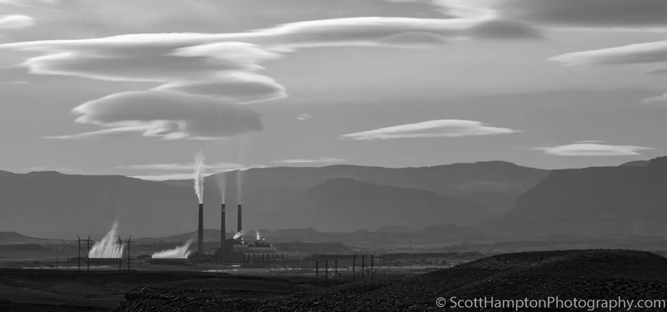
Hunter Power Plant, Utah.... Flying Saucers
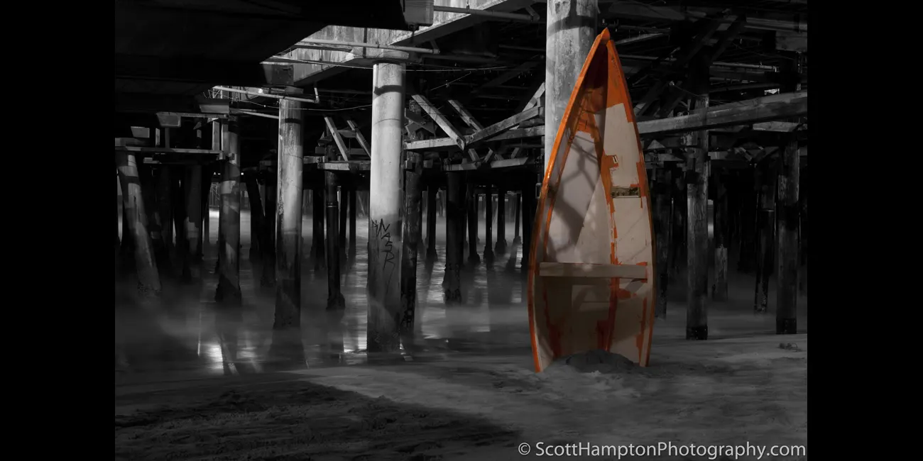
Under the Boardwalk, Santa Monica Pier
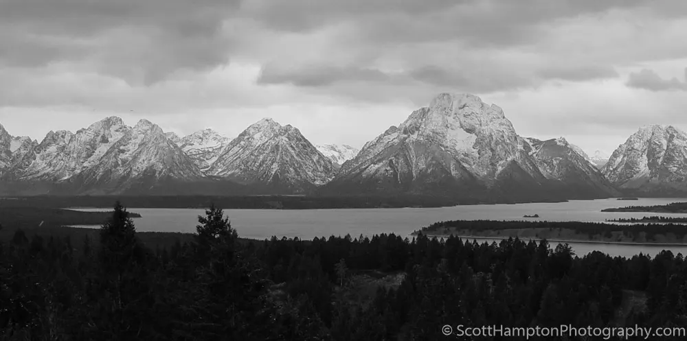
Mt. Moran, Jenny Lake Overlook
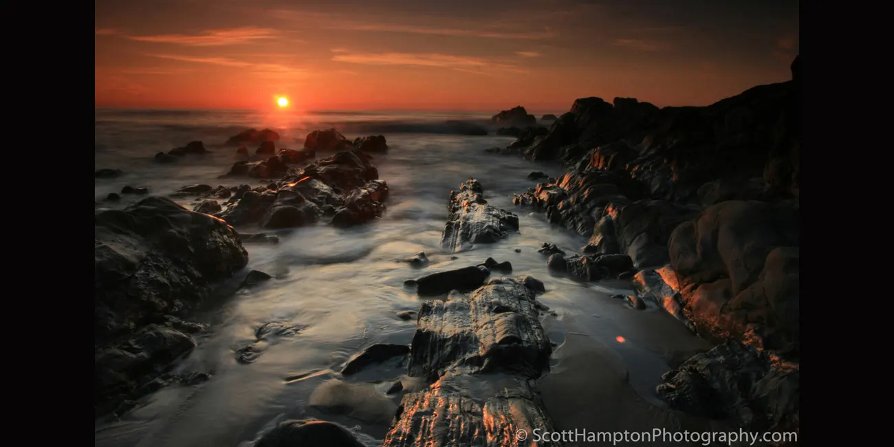
Pescadero… The last streaks of light
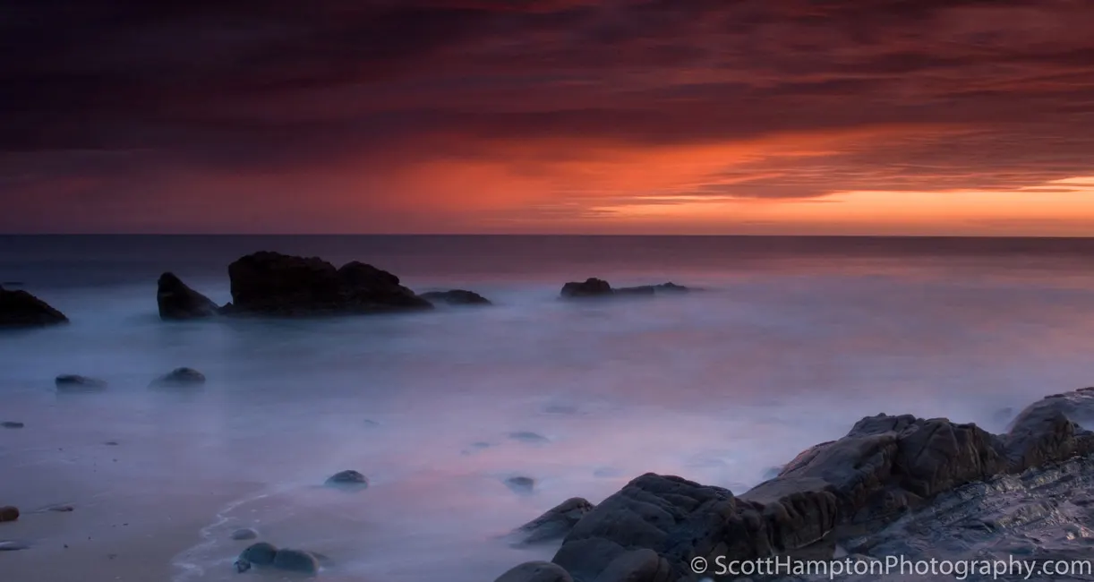
Shark Cove
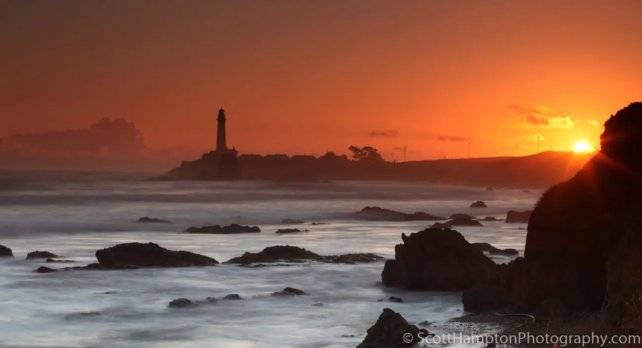
Pigeon Point, In between storms again!
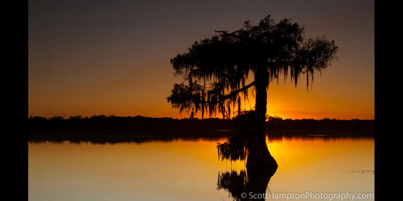
Atchafalaya Basin, Louisiana
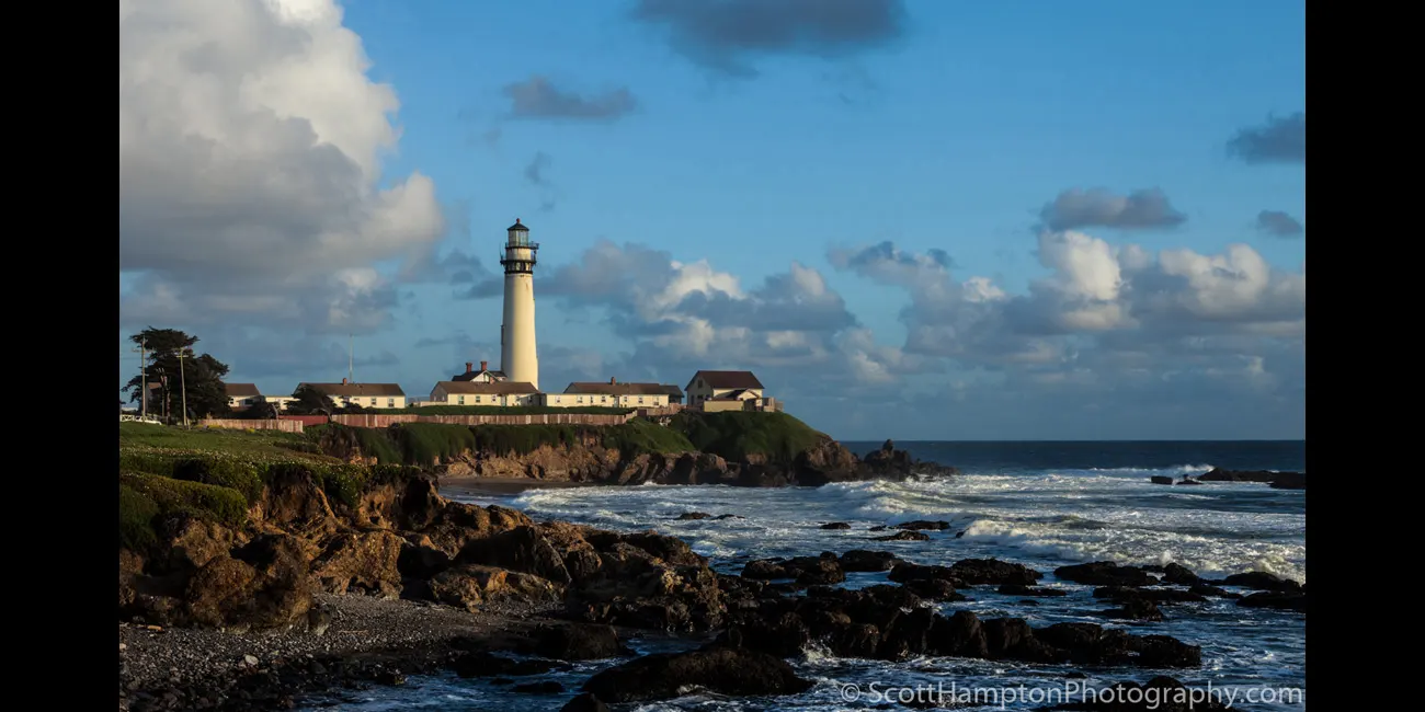
Pigeon Point Lighthouse
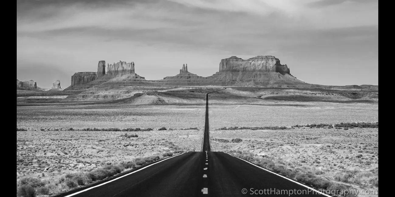
The Straight and Narrow
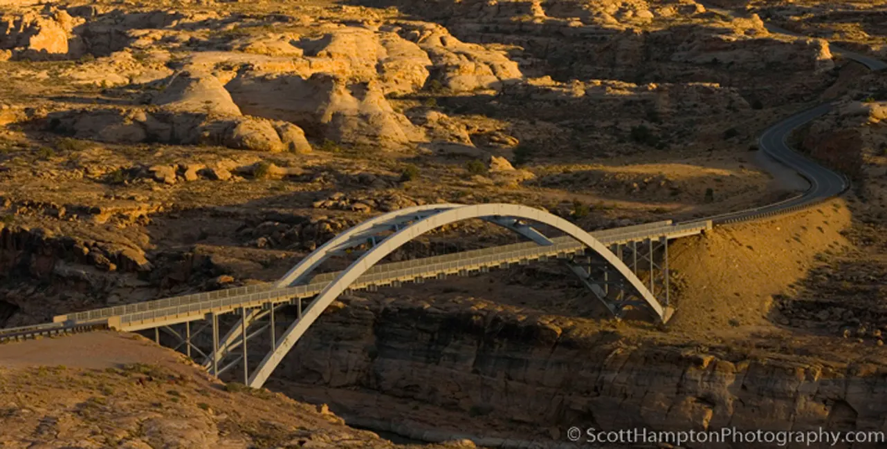
Sunset on the Hite Bridge
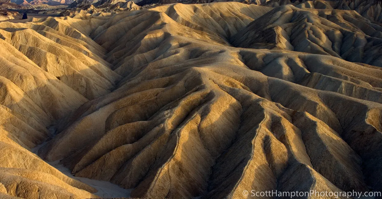
Zabriskie Point Death Valley
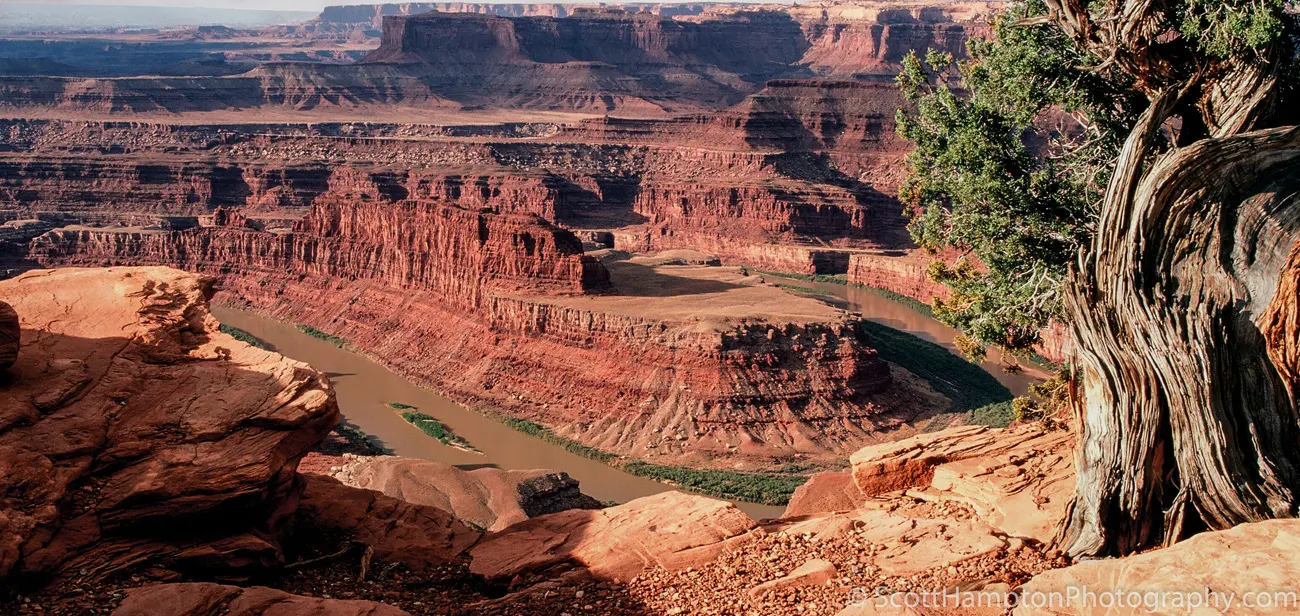
Dead Horse Point
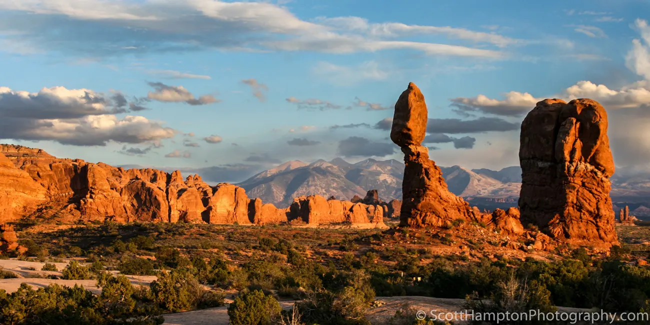
Balanced Rock II, Arches NP
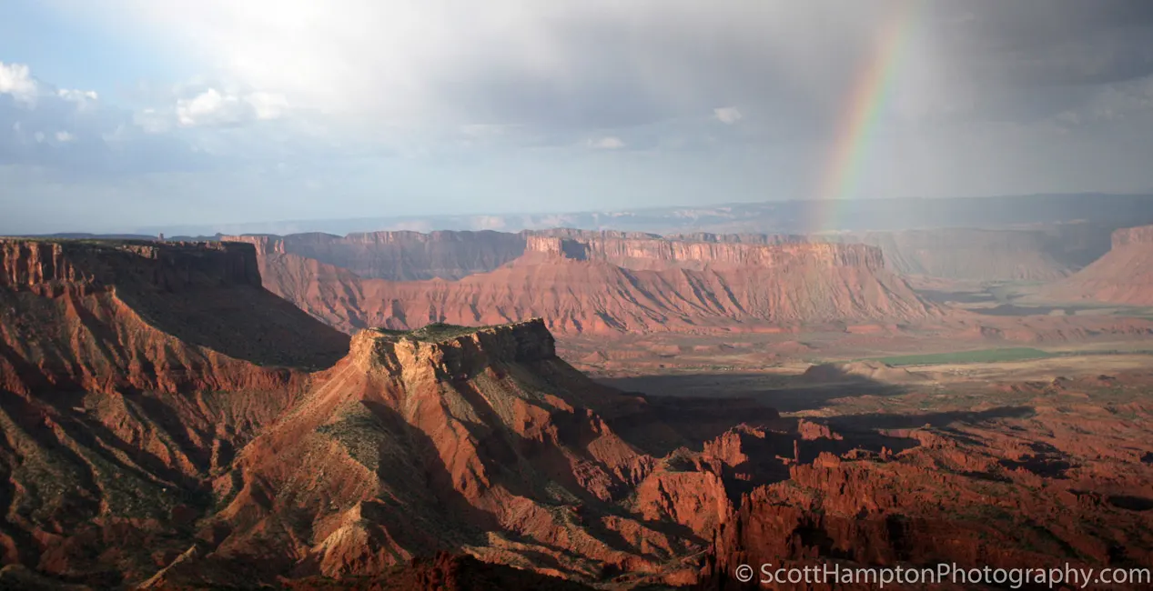
Cloudburst at the 'Top of the World'
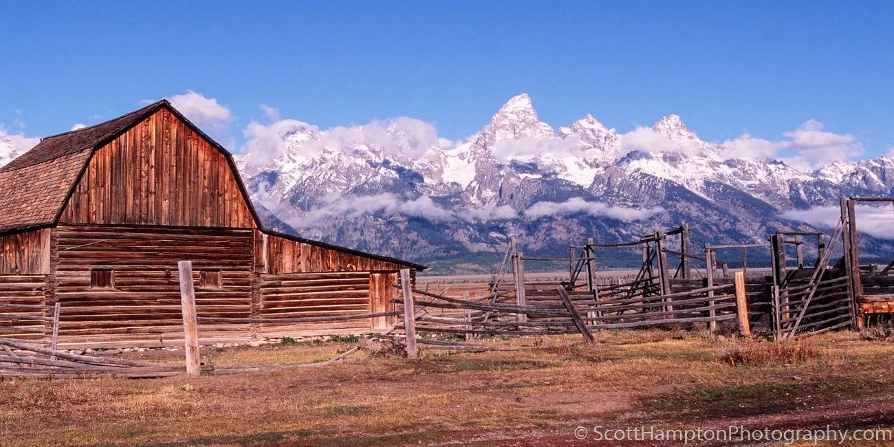
Morning Barn
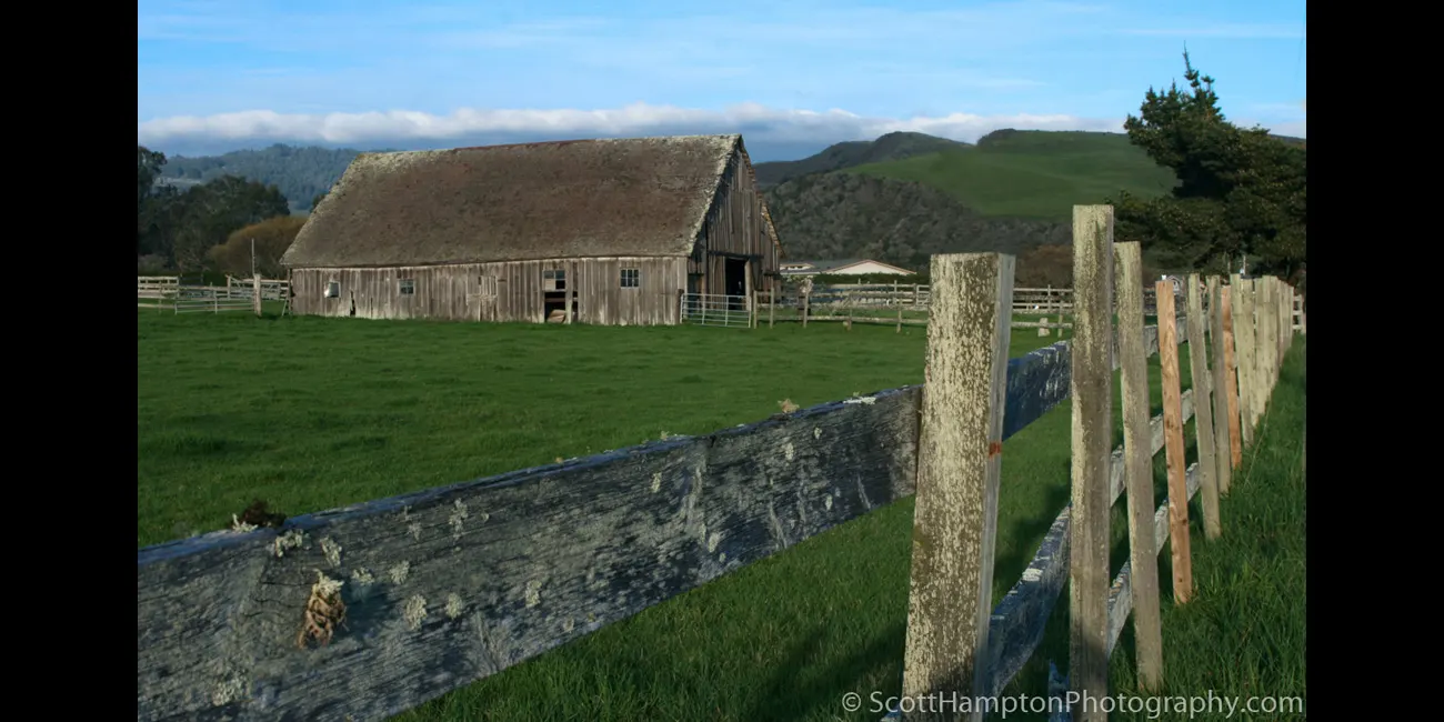
Just Another Barn that I Use to Know
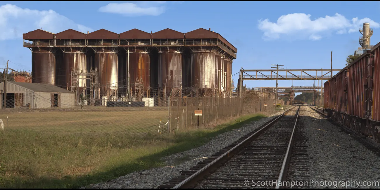
Sunshine Silos
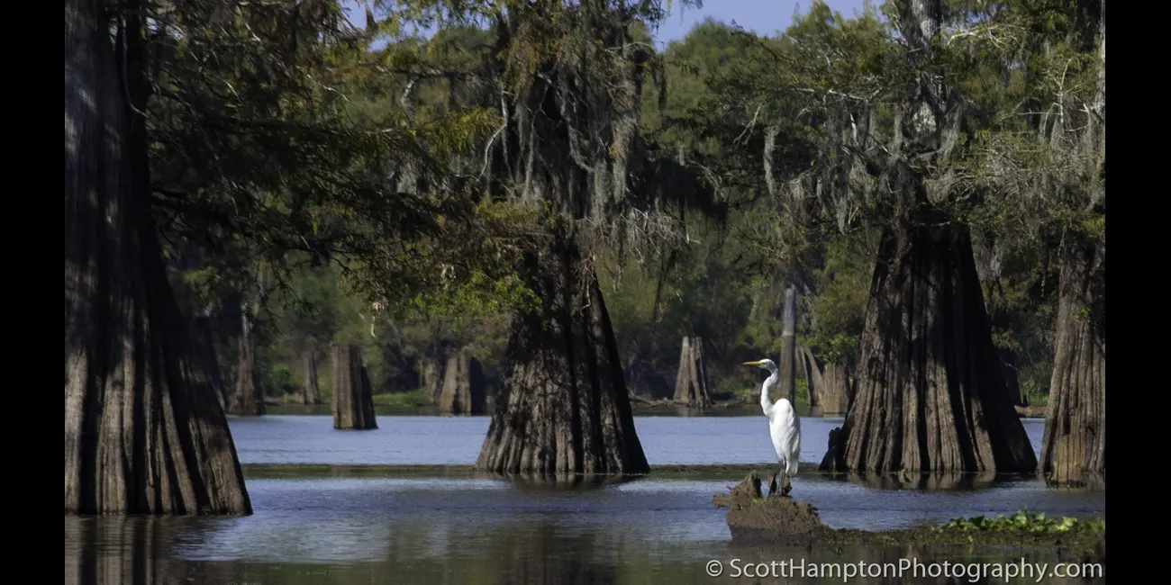
Throne of the Egret
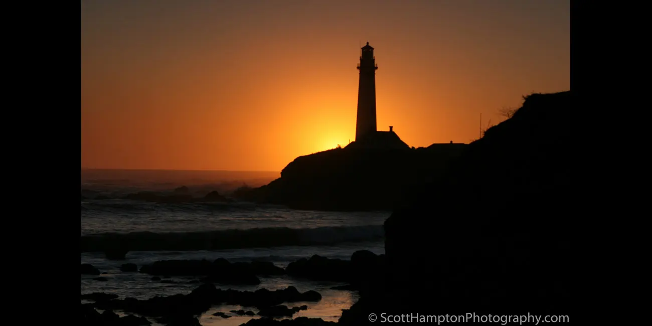
Sunset Behind Pigeon Point Lighthouse
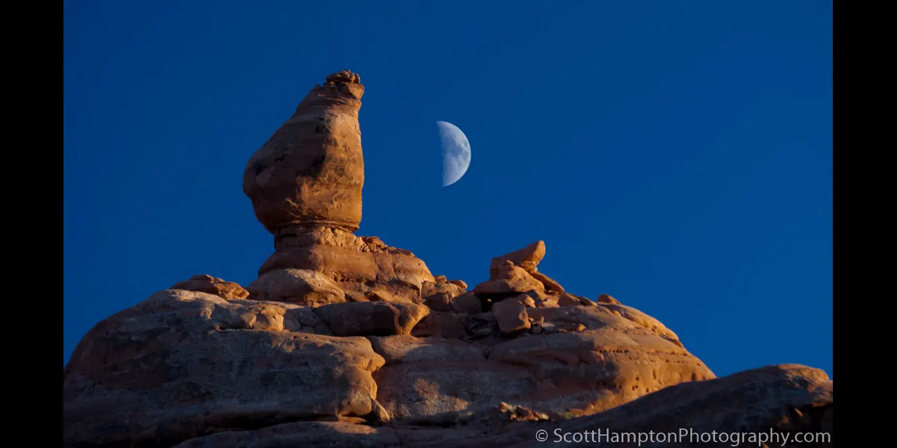
Ham Rock, Arches NP
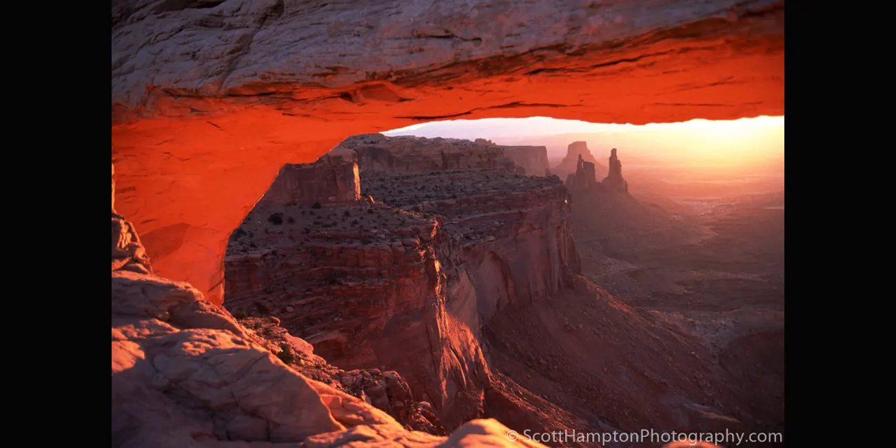
Mesa Arch, Canyonlands
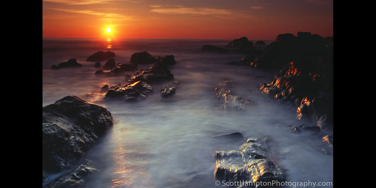
Prehistoric Pescadero
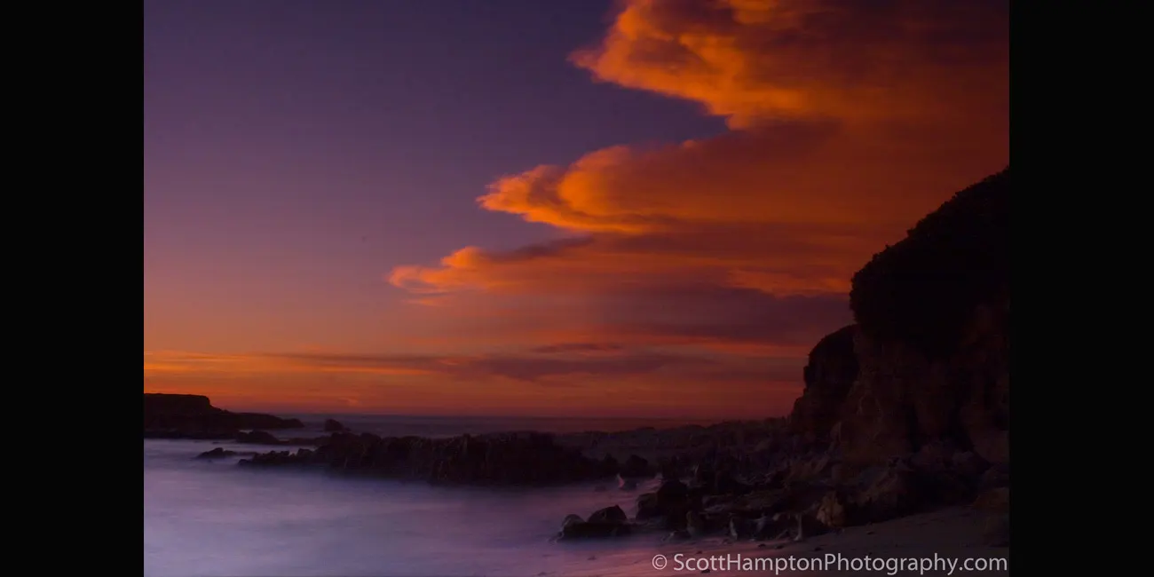
Pescadero Sunset
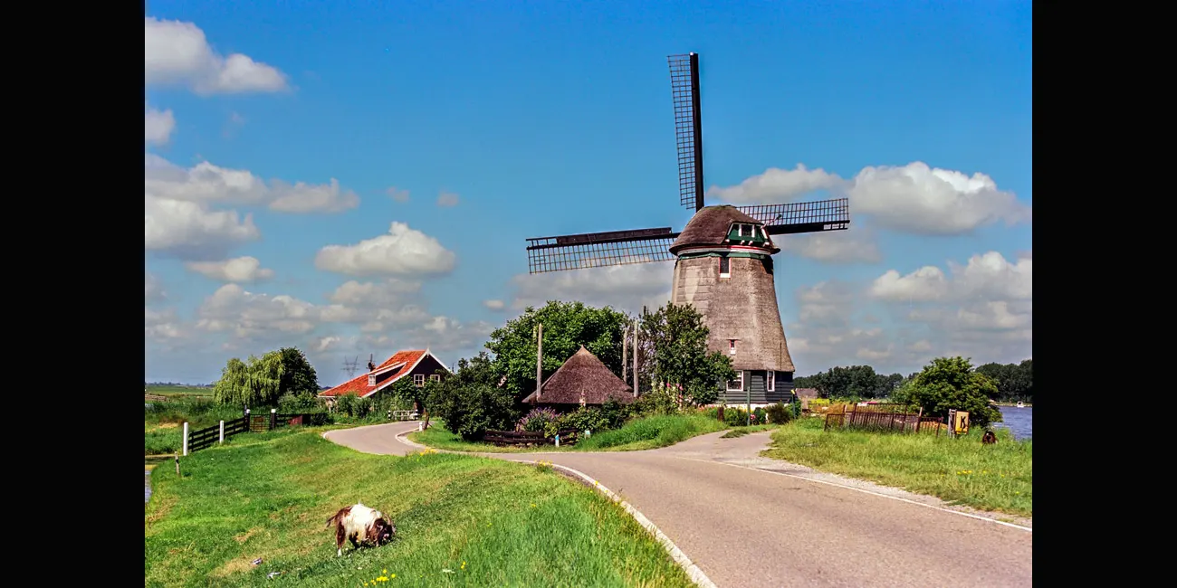
Grazing Goat
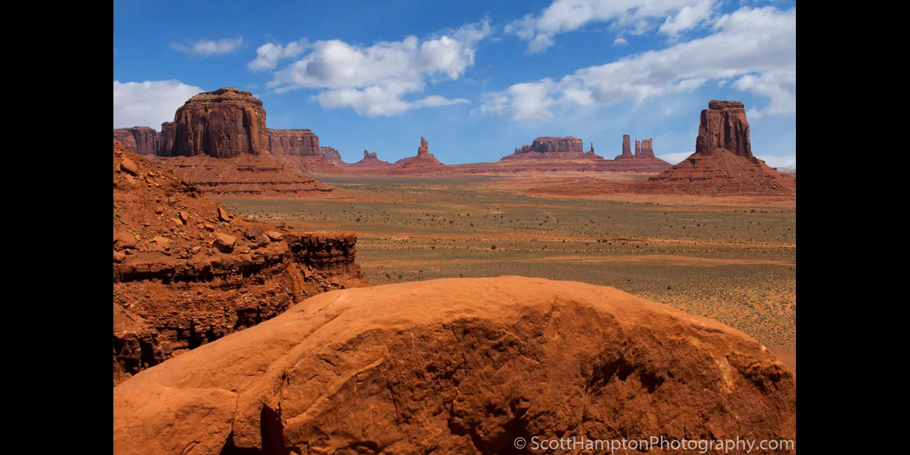
Monument Valley Overlook
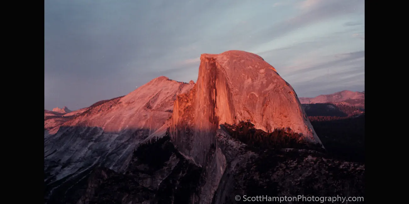
Half Dome at Sunset
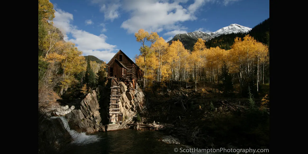
Crystal Mill, Colorado
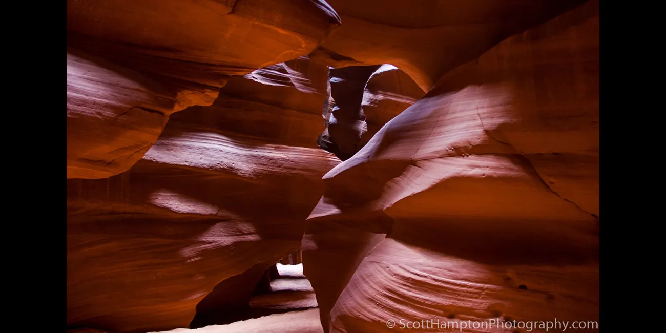
Antelope Canyon
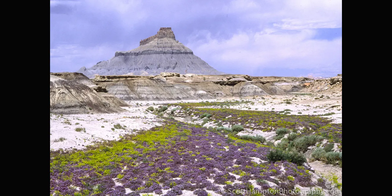
Factory Butte
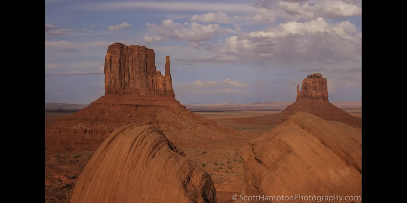
West & East Mitten Buttes, Monument Valley
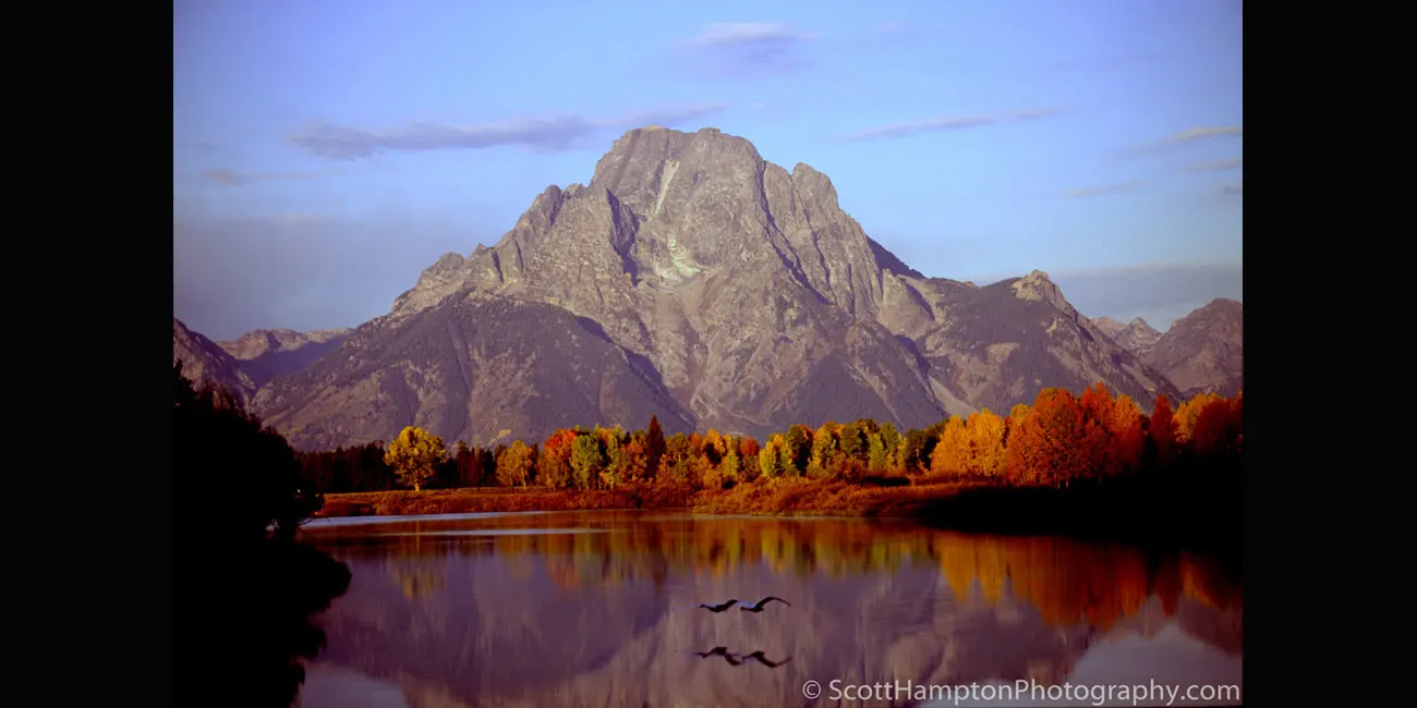
Fall Colors at Mt. Moran
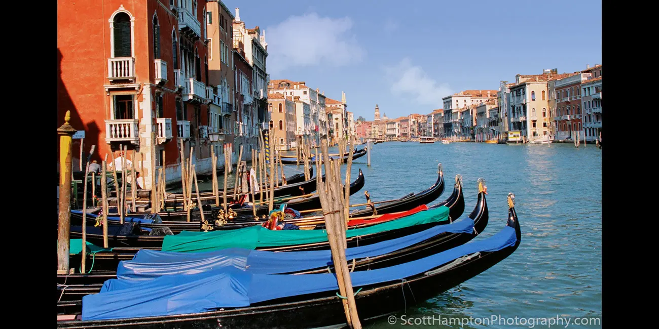
Gondolas of the Grand Canal
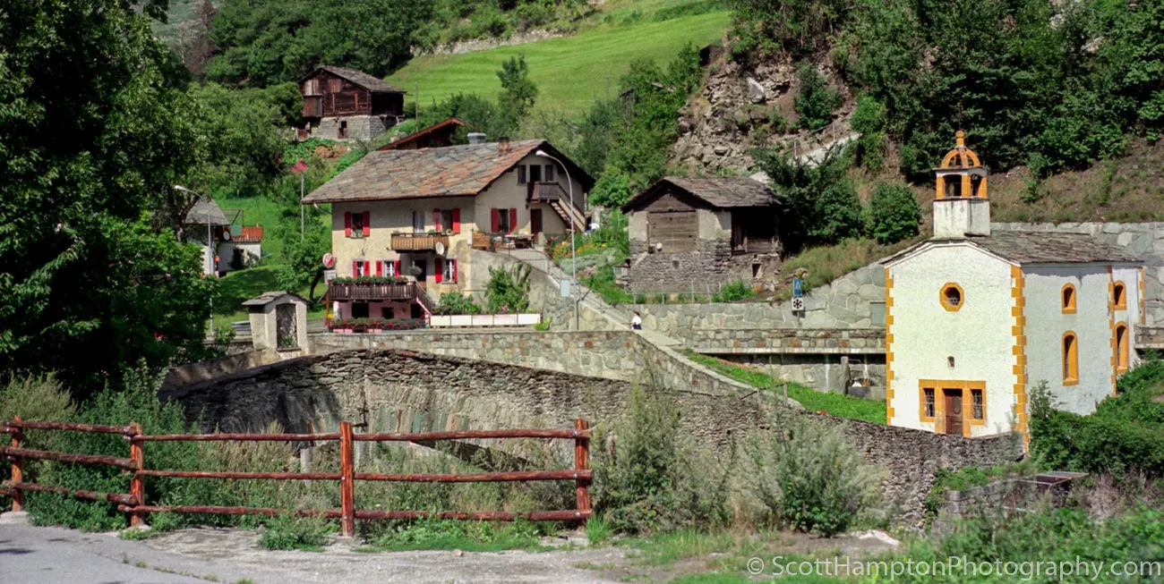
On the Road to Zermatt
Appartements le long du quai d'Orléans
Palace of Fine Arts, San Francisco
Princeton by the Sea Pier
San Francisco Nights
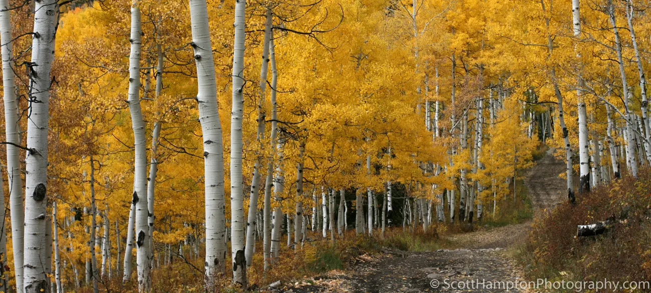
Aspen Road, Colorado
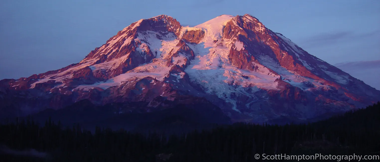
Mount Rainer
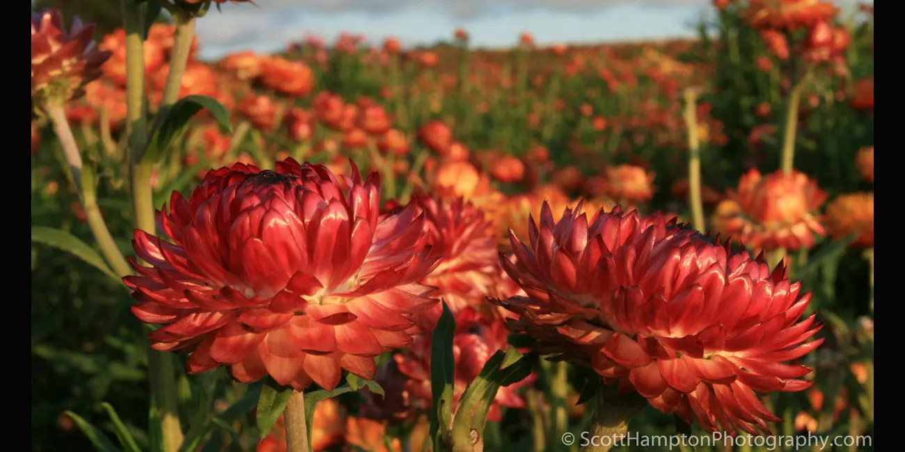
Lemon Hill Flower Farm
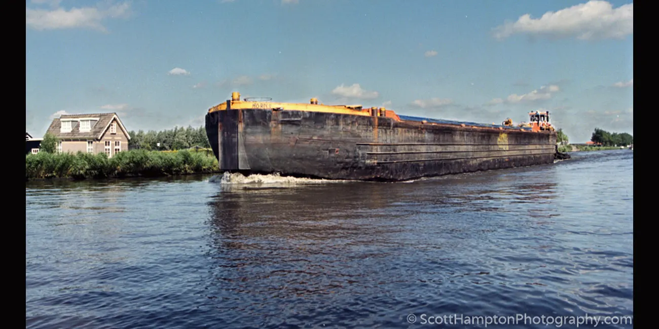
''Nederland Barge''
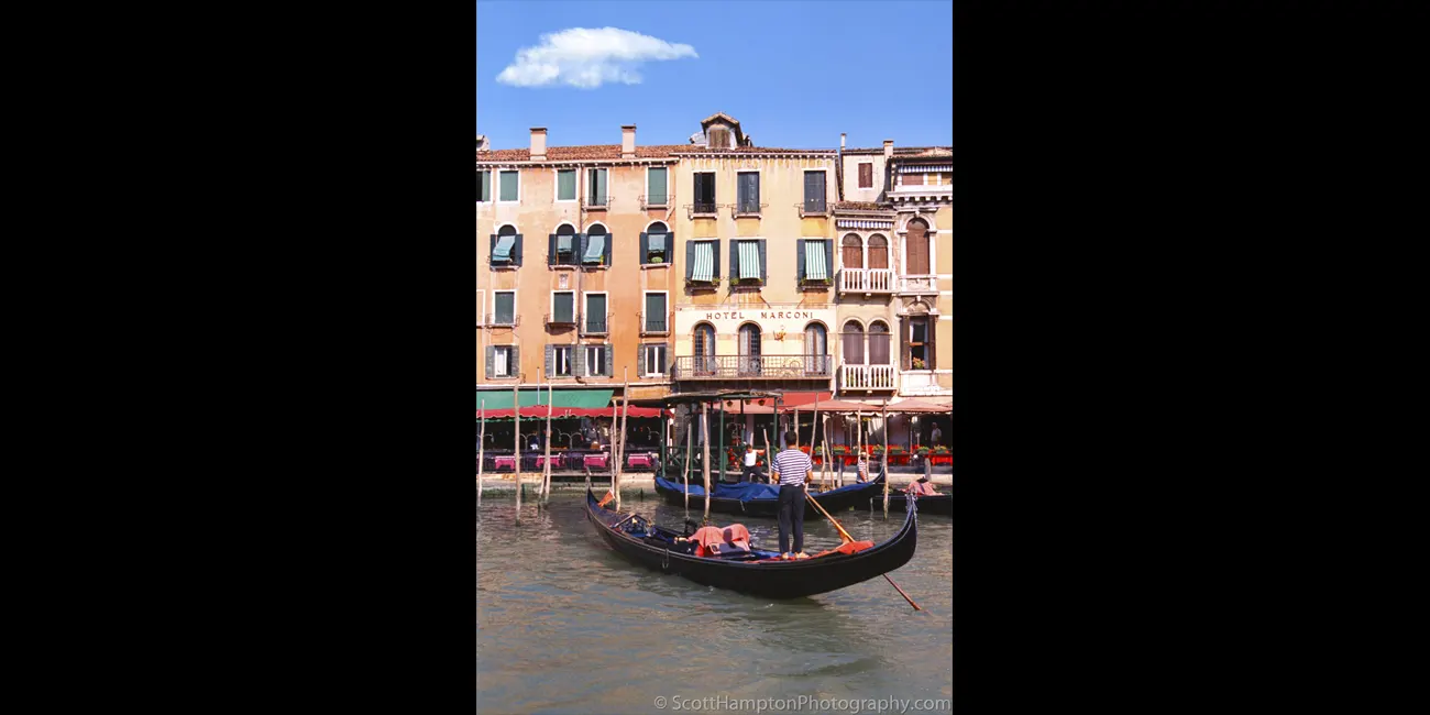
Hotel Marconi
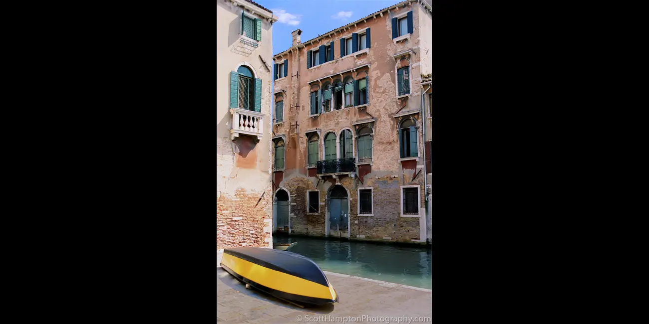
Barca dipinta di fresco
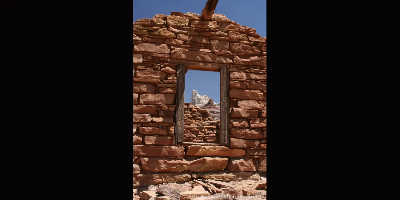
The Sphinx
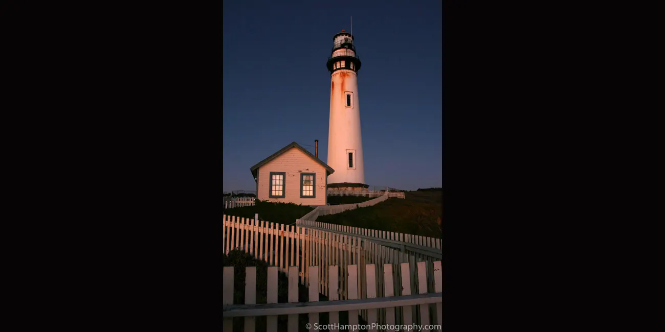
Pigeon Point Lighthouse, Alpine Glow
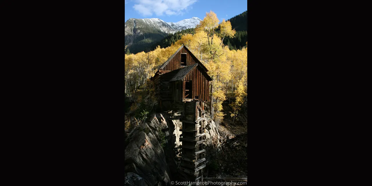
Crystal Mill

Thank You!

San Gimignano
San Gimignano is a small walled medieval hill town located in the Tuscany region. San Gimignano is famous for its medieval architecture, unique in the preservation of about a dozen of its tower houses which give it the nickname, “Manhattan of Italy.” Within the walls are well-preserved 14th and 15th century buildings of both Romanesque and Gothic architecture.
Swooping Cypress
Looks like the Cypress are swooping down to pick-up an unsuspecting traveler. The building at the end is a radio station (KPH.) This radio station was responsible for ship-to-shore communications for the central west coast portion of the United States back in the early Twentieth century. This station has been credited as being one of the last to broadcast Morse code in the United States. The powerful transmitting antenna was located 20 miles away as so it won't interfere with the sensitive receiving antenna designed to listen to ships that were hundreds of miles away.
Morro Bay Aviary
Okay, so I should know what kind of birds these are considering we were talking to a bird watcher who was walking down the beach. Of course I forgot what they are... typical. I’ve been to this area a few times now and I’ve always noticed how photogenic the power plant can be (almost sorry to say.) For one thing the smoke stacks are so high they can play cool tricks with the fog. This is much more evident in other captures.
Flying Saucers
Hunter Power Plant, This is my 1st posting of this backlit scene. I posted this simply because of the clouds. There are a bunch of ''saucer'' shaped clouds in the area but I couldn't work it in with this ''tight'' shot of the Hunter Power Plant. I made them look like the smoke stacks were feeding the clouds.
Under the Boardwalk
This is a long exposure (25 seconds) photographed just after sunset. Kind of neat how they leave that boat stuck in the sand. Haven’t noticed it in recent years, think it is gone.
Jenny Lake Overlook
A light dusting today. I dropped out of my tent pushing snow out the entrance as I 'shivered' my way to this scene. I darkened the photo to get more detail from the clouds. Seems okay even though it is so dark there are no detail towards the bottom half. Old pic, new visit!
The Last Streaks of Light
After doing some seascape photography this became the first day that I realized I would have to get my feet wet!! And so I did! They remained wet for about 90 minutes until I got home. I remember listening to the ''sloshing'' sound in my shoes as I was walking through the front door:-) Just a very small price to pay.
Shark Cove
It looks like shark fins in the water so that is why I called it Shark Cove. Shark Cove is not the real name of this place. This beach is just south of Pescadero, CA. With the exception of ND filters this photo is not enhanced.
In Between Storms Again!
This time Mother Nature left some clouds behind..... HOWEVER, Most of the good clouds disappeared about 30 minutes before this sunset. What a surprise!
Lake St. Martin, Atchafalaya Basin, Louisiana
Atchafalaya Basin is known as the "heart of the Louisiana Bayou." Saint Martin Lake is rather a small lake but is very scenic. This tree is known as a Bald Cypress. Adding to the beauty is the Spanish Moss hanging from the branches.
Pigeon Point Lighthouse
Back to one of my old haunts. I use to visit this area often back a few years ago but got tired of it so I moved on. I would pass it often on my way to other adventures, but would rarely stop. However, today I was very close and trying to figure where I was going to go for sunset. Obviously, I ended up here. This shot was taken about ½ hour before sunset.
The Straight and Narrow
This is one of those ‘’classic’’ road shots. This photograph was taken from Hwy 163 just south of a small town called Mexican Hat near the Arizona/Utah state line (USA.) I was quite excited to see a freshly paved road pointed straight to Monument Valley!
Sunset on the Hite Bridge
Sunset on the Hite Bridge. The bridge is the only automobile bridge spanning the Colorado River between the Glen Canyon Bridge, 185 miles downstream near the Glen Canyon Dam and the U.S. Route 191 bridge 110 miles upstream near Moab. This photograph was taken at the south end of a small airstrip.
Zabriskie Point, Death Valley
Death Valley, Zabriskie Point. The Toes of Time are Reaching Out!
Dead Horse Point
I love visiting this place not only for this view but also the wonderful views in nearby Canyonlands National Park. The sky was extremely overcast so I cropped the top of this photo. I remember I was too lazy to install my ND grad filter or perhaps this capture would have included a nice sky.
Balanced Rock II
Balanced Rock, one of the most iconic features in Arches National Park. Balanced Rock towers over 125 feet above the ground. I was blessed with some wonderful clouds left over from a storm that blew through a couple of hours ago.
Cloudburst at the 'Top of the World'
This spot is known as ''Top of the World'' near Onion Creek and Fisher Tower. Moab, UT. It took me over four hours to make the six-mile assent to this spot. I had to get out of my 4x4 several times just to line up rocks so I could ''stair step'' up the ledges.
Morning Barn
The Grand Tetons are some of the most beautiful mountains in the United States. One reason is because how these tall majestic mountains seem to pop out over the valley floor. The barn was built by Thomas Alma Moulton and his sons between about 1912 and 1945. It sits west of the road known as Mormon Row in an area called Antelope Flats.
Just Another Barn that I Use to Know
This is a barn that is less than two miles from Scenic Hwy 1, 20 miles south of San Francisco. I cannot believe I captured this eight years ago! Glad I went back into my archives to rediscover this!
Sunshine Silos
So named by me because it is just a little north of the Sunshine Bridge that crosses the Mississippi in Louisiana. Not sure exactly what this is. I don’t spend much time around industry so I cannot even guess. Obviously they are some kind of silos and I’m guessing they hold some type of chemical. This particular spot is about 1,250 feet from the Mississippi River. There are several pipe and conveyer belt ‘’bridges’’ that cross the rails to another small processing area. You can see a ‘’stack’’ on the right side above the rail road cars. From there they have similar pipe and conveyer belt ''bridges'' that reach over the levies and load their product directly onto the ships waiting in the Mississippi River. I looked on Google Earth and there are three large docks with several ‘’loading crane barges.’’ I see the next refinery south (about 2,000 feet) is labeled as DuPont. DuPont’s property has a relatively modest dock which makes me wonder this silo/property might also be owned by DuPont.
I do believe this area is also called Cancer Alley. If I recall correctly DuPont commissioned a study which found no alarming cancer rates in this area. Sadly, the residents in this area do not have the resources to commission their own study which would probably contain more accurate results.
Throne of the Egret
Egrets are herons that have white or buff plumage, develop fine plumes (usually milky white) during the breeding season. Egrets are not a biologically distinct group from the herons and have the same build. The word "egret" comes from the French word aigrette that means both "silver heron" and "brush", referring to the long, filamentous feathers that seem to cascade down an egret's back during the breeding season (also called "egrets".)
Sunset Behind Pigeon Point Lighthouse
Using a two stop grad filter and underexposing it by another full stop.
Ham Rock, Arches NP
On my way to capture a sunset at "Windows" (Arches NP) when I saw this. I decided to forgo Windows in place of this one! Moved further out and zoomed in more to make the moon look bigger in relation to Ham Rock.
Mesa Arch Sunrise
Typical "Classic" shot.. Shot in 2001 just before this spot got so popular. I used a Canon 1N (28-70zoom) and Velvia film. I tried shooting here in 2005 but it got so popular I had to contend with 15 - 20 other photographers.
Prehistoric Pescadero
This is the same time I got the ''The Last Streaks of Light'' shot with my Canon XTi. Judging from the suns position I would say this image was recorded 2 - 3 minutes before the XTi shot: ''The Last Streaks of Light.''
- Canon 1N with Velvia 50 (film).
- Scanned with a Dimage F-2900 Film Scanner.
- No enhancements except for using NDs and ND grad filters which are placed in front of the lens during the capture. No digital enhancements (No Photoshop!)
Pescadero Sunset
The rocks are very dark so I lightened the whole image. I also did some extra ''dodging'' on the rocks and foreground. The rocks are still too dark but I'm afraid it will look too fake if brighten up the rock anymore.
Grazing Goat
Nice windmill located on the riverbank. Off to the right are two men fishing but I cropped that out. I tried to get closer to the goat, but it was a little shy.
Monument Valley Overlook
I added a little blue to the sky. Would not have had to do this if I did not forget my polarizer filter.
Half Dome at Sunset
This was a lucky situation. It was overcast without any direct sunlight for a good part of the afternoon (all you have to do is look at the sky in the background.) I went up here to Glacier Point (I think thats the name) knowing I'm working on a cliche shot (shot here at least ten times before this shot.) I remember setting up and watching one person walking away and saying ''it isn't going to happen tonight'' I agreed with this person's statement but will never leave a site until I know the sun is gone. There is actually a gap between the mountains (Yosemite Valley) that allow the setting sun to shine its color on Half Dome. Due to the Sun's azimuth during the seasons this gap is only available a few weeks each year (this being one of those times.) Anyways, I was never able to get a good look to the west to see if there were any cloud breaks/gaps to allow for a good sunset. Lucky enough the sun was able to break thought the clouds and in less than two minutes it was over.
Crystal Mill III, Colorado
Crystal Mill was built in 1892. Crystal Mill is a ‘’horizontal waterwheel’’ located on an outcrop above the Crystal River near Crystal, Colorado. Instead of creating electricity or grinding grain, Crystal Mill powered an air compressor (pneumatic compressor.) This compressor was responsible for powering pneumatic tools (drills and hammers) across the whole mountain for mining silver.
Antelope Canyon
A major attraction made popular because of photography. Ironically it is almost impossible to capture a good long exposure because there are too many people walking through. If I understand correctly there are no more photography tours because the park officials feel it is slowing down all the tours they feed through this place. Talking about biting the hand that feeds you!
Factory Butte
I was thinking of walking across the dried riverbed to get tighter shots on the purple plants, however, I realized that Factory Butte would have been hidden by the plateau in front of it. As I am writing this I realize just how many ''life cycles'' this river went through. It is amazing! This type of hydrolyzation is common throughout Southern Utah and Northern Arizona.
East Mitten Buttes
East and West Mitten Buttes in Monument Valley. Another classic area to photograph.
Fall Colors at Mt. Moran
This is one of my favorite images of Mt. Moran. Mainly because I caught the Osprey crossing the river. It was nerve-racking at first because I saw the birds crossing and I knew I had a two second delay on the shutter (mirror-up.) I triggered it immediately and can still recall to this day hearing the click while watching the birds crossing the river. I knew I had it even without that handy LCD screen! Glad the camera wasn't set for long-exposure!
Gondolas de Canal Grande II
Another more classic that a Gondola in Venice. Walking down on of Venice’s famous arched bridges I noticed this nice ‘setup’ for a picture down the Grand Canal. There happened to be a dock along where I stood which helped me frame everything nicely.
On the Road to Zermatt
Zermatt is a classic Swiss mountain village located under the Matterhorn. In order to get to the Zermatt you must park your car and take a train for the last few kilometers. I began exploring the area as I’m waiting for the train. This is a beautiful area with classic homes, a church, and a beautiful stone bridge. I remember wishing the fence was not there but I was able to crop the photo in such a way that it now enhances the picture (in my opinion.)
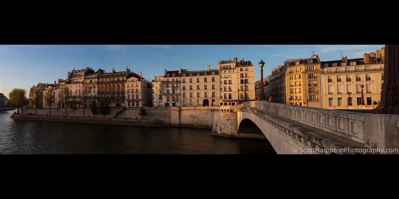
Appartements le long du quai d'Orléans
This photo was captured from the Pont de la Tournelle bridge looking across the Seine River. The buildings across the river are ments along the quai d'Orléans. The quai d'Orléans (the road) was constructed between 1614 and 1646. I was in this area waiting for the sun to set on the Notre-Dame de Paris when I noticed how nice the late sunlight looked as it bathed the ments across the Seine River.
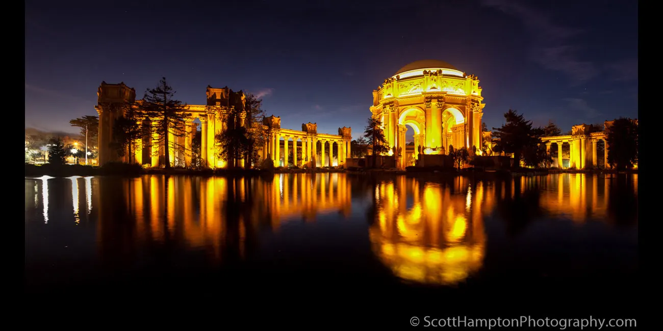
Palace of Fine Arts, San Francisco
The Palace of Fine Arts is located in the Marina District of San Francisco, California. It was originally constructed in 1915 to host works of art for the Panama-Pacific Exposition. In addition to hosting art exhibitions, it remains a popular attraction for tourists and locals and is a favorite location for weddings and wedding party photographs for couples throughout the San Francisco Bay Area.
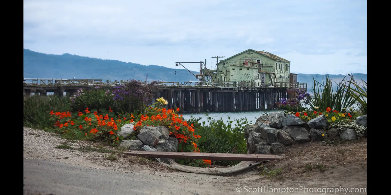
Princeton by the Sea Pier
About 20 miles to the south of San Francisco lies Princeton-by-the-Sea Pier. Not sure about the history of this pier but apparently Portuguese sailors from the Azores (WOW) ran a whaling station here from the 1860s thru the 90s. This pier is located less than a mile from the world-famous Mavericks beach (surf area.)
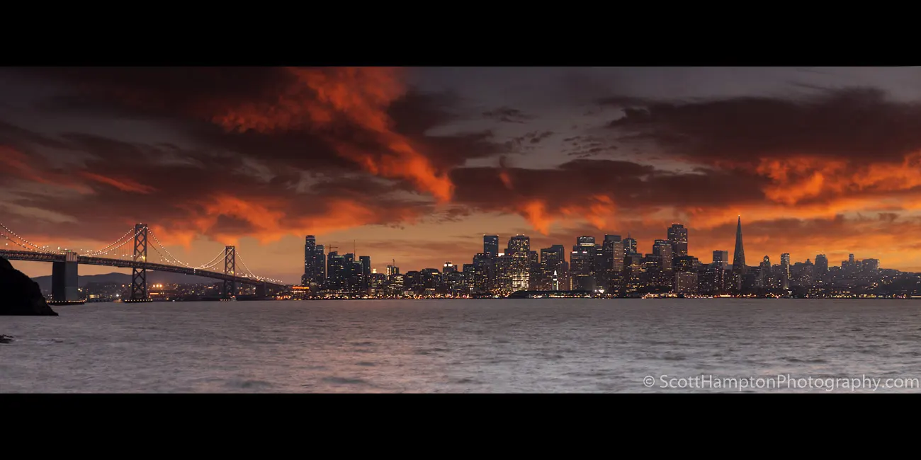
San Francisco Nights
I live about 40 minutes from this location. At times when I'm in the mood I'll look at the San Francisco webcams to see how the clouds are forming. I also check the internet for the fog report. Even with all this forethought I feel blessed to arrive at this location and to be treated to a wonderful light show like this! The original capture included the Golden Gate Bridge and Coit Tower but I removed it because it was too wide and I was afraid the city would have gotten lost.
This is a panorama (obviously) and a composite using 13 images. Typically, when I do sunsets I expose for the clouds and then take another shot exposing for the subject (or the shadows.) This was no exception, except it is a panorama (multiple shots stitched into one image) so aligning the two different images was quite challenging. I took the original sunset pano and dropped the city buildings back in using a pano that was exposed for the city 10 minutes later (this is the ‘composite’ component.)
Aspen Road, Colorado
This is near Crystal Mill which is about 30mi west of Aspen, Colorado.
Mount Rainer
Got lucky here. The spot I'm shooting from was covered by clouds just 15 minutes before I took this sunset shot! Mount Rainer, Washington, USA. August 2005
Lemon Hill Flower Farm
As I parked in my usual spot at Pescadero I happened to look across the road and saw a flower farm in complete bloom! Naturally I had to take a look!! I call this the Lemon Hill Flower Farm just because that is the name of the dirt road use to access this farm. This area is known for flower farming... It is close to Half Moon Bay, California, USA.
Nederlands Gracht
I was trying to get a good shot of the cottage across the canal. I was amazed how the canal looked like it was higher than the bottom floor of the cottage (and it is.) They don't call it Nederland for nothing! So here I was minding my own business when this tugboat decided to push this barge up the canal and in the way of my shot! Bummer!!
Hotel Marconi, Grand Canal Taxi
My 1st hour in Venice. I was going to my hotel in what the locals call a bus (really a small ferry.) I was so excited I was snapping off pictures at everything that looked like a possibility. Didn't have time for ''setting up'' since we were moving too fast. Just happened to get this one in!!
Barca dipinta di fresco
This person just painted their boat. Wondering aimlessly in Venice can be a lot of fun.
The Sphinx
Found this by accident. I framed Temple Mountain in the window frame. Looks like a Sphinx! This is a ‘’geographical entrance’’ for an area known for the early mining of Uranium (1940s.) I have traveled through here several times and can almost always see the ‘yellow’ layer of Uranium buried in the cliffs and buttes. This area is considered safe as long as you do not explore the (many) mine shafts located in the area.
Pigeon Point Lighthouse, Alpine Glow
Set on a cliff on the central California coast 50 miles south of San Francisco. The 115-foot Pigeon Point Lighthouse is one of the tallest lighthouses in America. Its five-wick lard oil lamp and first-order Fresnel lens, comprised of 1,008 prisms, was first lit at sunset on Nov. 15, 1872. The lens stands 16 feet tall, is 6 feet in diameter and weighs 2,000 pounds. The lens was removed in November 2011 for restoration but has not been replaced as of 2020.
This image was captured over 20 minutes after sunset.
Crystal Mill
Crystal Mill was built in 1892. Crystal Mill is a ‘’horizontal waterwheel’’ located on an outcrop above the Crystal River near Crystal, Colorado. Instead of creating electricity or grinding grain, Crystal Mill powered an air compressor (pneumatic compressor.) This compressor was responsible for powering pneumatic tools (drills and hammers) across the whole mountain for mining silver.
My name is Scott and this is my second major website revision for ScottHamptonPhotography.com. I am an IT pro but not a website designer. My old photography website was very ‘’static’’ looking and needed to be moved into the modern world. Luckily I was able to find an app that helped me move my website into the modern age! As a result, this site is currently in development and has minimal navigational (or any other) features at this time(November 2015.)


